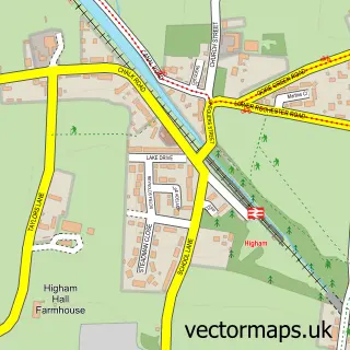
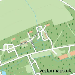
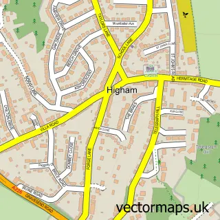
This Cliffe Woods street map is a detailed vector street map covering a 750m x 750m area. Select a larger area to create and download your own vector street map of Cliffe Woods.
The 750-metre map sample for Cliffe Woods covers 612 mapped buildings and approximately 15.2 km of road detail, of which 29 named roads are named. The immediate area includes 1 school, 1 GP surgery and 1 MOT station, with 3 within 2 miles. The wider area around Cliffe Woods features 1 tourism point of interest. To create a larger or custom map of Cliffe Woods, the map builder lets you define your own coverage area and download editable SVG, PDF and PNG files.
Create a larger editable map of Cliffe Woods
Choose any area you need and generate a high-quality vector map instantly. Perfect for print, planning, design, business and personal use.

This Cliffe Woods street map in Kent is available as downloadable SVG, PDF and PNG map files, or as a printed map for planning, business, display, education, local information and design work. You can also create a larger custom map area using the map selector.
What this Cliffe Woods map sample shows
Cliffe Woods lies within Cliffe And Cliffe Woods Cp parish, part of Strood Rural ward in the Medway (B) local authority area. The postcode geography for this area includes the ME postcode area, the ME3 postcode district and the ME3 8 postcode sector. Residents fall under the Nhs Kent And Medway Integrated Care Board for NHS services.
Local features near Cliffe Woods
Within 2 milesAmenities and services in and around Cliffe Woods.
Administrative and postcode information for Cliffe Woods
Cliffe Woods lies within Cliffe And Cliffe Woods Cp parish, part of Strood Rural ward in the Medway (B) local authority area. The postcode geography for this area includes the ME postcode area, the ME3 postcode district and the ME3 8 postcode sector. Residents fall under the Nhs Kent And Medway Integrated Care Board for NHS services.
Nearby street map samples around Cliffe Woods

More street maps in Kent
750 metre map area coverage
Boundary, postcode and point of interest information for the 750m x 750m rectangle centred on this sample map.
Boundaries containing map centre
Constituency: Rochester and Strood Co Const
District: Medway (B)
Icb: NHS Kent and Medway ICB
Parish: Cliffe and Cliffe Woods CP
Police Force: kent
Postcode District: ME3
Postcode Sector: ME3 8
Ward: Strood Rural Ward
Nearby boundaries intersecting sample
Postcode Sector: ME3 7
Postcode coverage
POI category counts
Beauty Salon: 4
Bridal Shop: 2
Building Supply Store: 2
Charity Organization: 2
Contractor: 2
Convenience Store: 2
Doctor: 2
Driving School: 2
Hair Salon: 2
Home Service: 2
Sample points of interest
- D M G Designs
- Autoshoppe
- April Courtney Permanent Makeup
- Lisa Sewell Permanent Makeup & Training Academy
- Ruby & White Hairdressers
- Totally Charmed Beauty
- Orchard B & B
- Heartfelt Photography
- Odds Car Hire
- 1st Industrial & Commercial Services
- Liftec Crane Hire
- Proud Business Productions
Create a larger editable map of Cliffe Woods
This sample shows only a 750 metre area. To create a larger map of Cliffe Woods, use our map builder to choose your own coverage area, add titles and download editable SVG, PDF and PNG files.
Create a custom map of Cliffe Woods