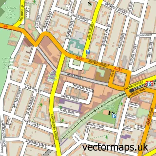
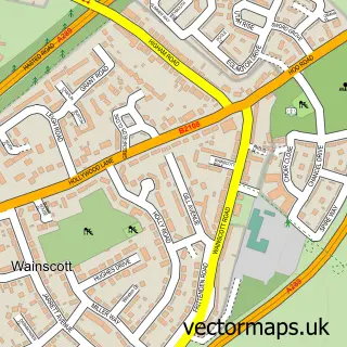
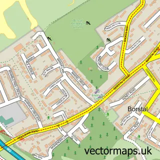
This Brompton street map is a detailed vector street map covering a 750m x 750m area. Select a larger area to create and download your own vector street map of Brompton.
The 750-metre map sample for Brompton covers 130 mapped buildings and approximately 10.6 km of road detail, of which 22 named roads are named. The immediate area includes 1 school, 12 GP surgeries within 2 miles and 36 MOT stations within 2 miles. The wider area around Brompton features 2 tourism points of interest and 2 hotels. To create a larger or custom map of Brompton, the map builder lets you define your own coverage area and download editable SVG, PDF and PNG files.
Create a larger editable map of Brompton
Choose any area you need and generate a high-quality vector map instantly. Perfect for print, planning, design, business and personal use.

This Brompton street map in Kent is available as downloadable SVG, PDF and PNG map files, or as a printed map for planning, business, display, education, local information and design work. You can also create a larger custom map area using the map selector.
What this Brompton map sample shows
Brompton lies within Medway (B) parish, part of Gillingham North ward in the Medway (B) local authority area. The postcode geography for this area includes the ME postcode area, the ME7 postcode district and the ME7 5 postcode sector. Residents fall under the Nhs Kent And Medway Integrated Care Board for NHS services.
Local features near Brompton
Within 2 milesAmenities and services in and around Brompton.
Administrative and postcode information for Brompton
The local authority covering Brompton is Medway (B), within the county of Kent. The settlement lies within Gillingham North ward and Medway (B) civil parish. The ME7 postcode district and ME7 5 postcode sector serve the immediate area. NHS provision in the area is delivered through Medway Nhs Foundation Trust.
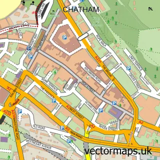
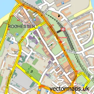
Nearby street map samples around Brompton

More street maps in Kent
750 metre map area coverage
Boundary, postcode and point of interest information for the 750m x 750m rectangle centred on this sample map.
Boundaries containing map centre
Constituency: Rochester and Strood Co Const
District: Medway (B)
Icb: NHS Kent and Medway ICB
Police Force: kent
Postcode District: ME7
Postcode Sector: ME7 5
Ward: Chatham Central & Brompton Ward
Nearby boundaries intersecting sample
Constituency: Gillingham and Rainham Boro Const
Postcode District: ME4
Postcode Sector: ME4 4, ME7 1
Ward: Gillingham North Ward, Gillingham South Ward
Postcode coverage
POI category counts
Sports Club And League: 7
Armed Forces Branch: 3
Public And Government Association: 3
Convenience Store: 2
Gym: 2
Hotel: 2
Stadium Arena: 2
Active Life: 1
Alternative Medicine: 1
Assisted Living Facility: 1
Sample points of interest
- Gymaid
- The Kent Institute of Clinical Hypnosis
- Brompton Barracks
- Chatham Royal Engineer's Barracks
- The Lampard Centre
- Mansion House
- Greggs
- Avis Budget UK
- Hertz Rent a Car
- MidKent College Gillingham Campus
- Costcutter
- Costcutter
Create a larger editable map of Brompton
This sample shows only a 750 metre area. To create a larger map of Brompton, use our map builder to choose your own coverage area, add titles and download editable SVG, PDF and PNG files.
Create a custom map of Brompton