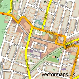
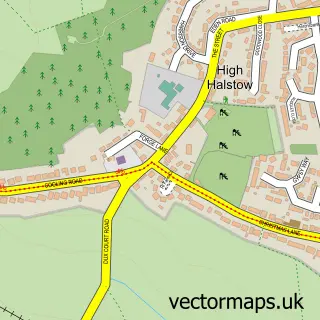
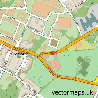
This Hoo St Werburgh street map is a detailed vector street map covering a 750m x 750m area. Select a larger area to create and download your own vector street map of Hoo St Werburgh.
The 750-metre map sample for Hoo St Werburgh covers 653 mapped buildings and approximately 21.5 km of road detail, of which 38 named roads are named. The immediate area includes 1 GP surgery, with 3 within 2 miles, 1 pub and 4 MOT stations within 2 miles. The wider area around Hoo St Werburgh features 1 food and drink venue. To create a larger or custom map of Hoo St Werburgh, the map builder lets you define your own coverage area and download editable SVG, PDF and PNG files.
Create a larger editable map of Hoo St Werburgh
Choose any area you need and generate a high-quality vector map instantly. Perfect for print, planning, design, business and personal use.

This Hoo St Werburgh street map in Kent is available as downloadable SVG, PDF and PNG map files, or as a printed map for planning, business, display, education, local information and design work. You can also create a larger custom map area using the map selector.
What this Hoo St Werburgh map sample shows
Hoo St Werburgh lies within Hoo St. Werburgh Cp parish, part of Peninsula ward in the Medway (B) local authority area. The postcode geography for this area includes the ME postcode area, the ME3 postcode district and the ME3 9 postcode sector. Residents fall under the Nhs Kent And Medway Integrated Care Board for NHS services.
Local features near Hoo St Werburgh
Within 2 milesAmenities and services in and around Hoo St Werburgh.
Administrative and postcode information for Hoo St Werburgh
The local authority covering Hoo St Werburgh is Medway (B), within the county of Kent. The settlement lies within Peninsula ward and Hoo St. Werburgh Cp civil parish. The ME3 postcode district and ME3 9 postcode sector serve the immediate area. NHS provision in the area is delivered through Medway Nhs Foundation Trust.
Nearby street map samples around Hoo St Werburgh

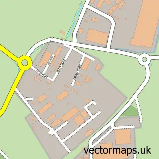
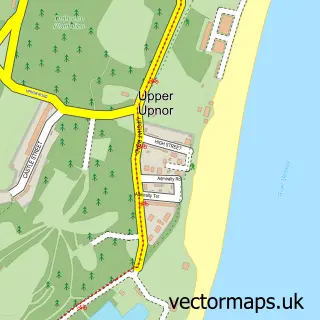
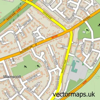
More street maps in Kent
750 metre map area coverage
Boundary, postcode and point of interest information for the 750m x 750m rectangle centred on this sample map.
Boundaries containing map centre
Constituency: Rochester and Strood Co Const
District: Medway (B)
Icb: NHS Kent and Medway ICB
Parish: Hoo St. Werburgh CP
Police Force: kent
Postcode District: ME3
Postcode Sector: ME3 9
Ward: Hoo St. Werburgh & High Halstow Ward
Nearby boundaries intersecting sample
No additional intersecting boundaries found.
Postcode coverage
POI category counts
Beauty Salon: 3
Building Supply Store: 3
Convenience Store: 3
Construction Services: 2
Contractor: 2
Dentist: 2
Doctor: 2
Elementary School: 2
Funeral Services And Cemeteries: 2
Martial Arts Club: 2
Sample points of interest
- Not Just A Piece Of Cake
- NatWest
- Five Bells
- Hairtrends
- Wink Aesthetics Kent
- Beautiful Hoo
- The Beauty House
- XOXO Aesthetics
- Coral
- Deluxe Window Cleaning Kent
- Kev's Plumbing
- T D S Services
Create a larger editable map of Hoo St Werburgh
This sample shows only a 750 metre area. To create a larger map of Hoo St Werburgh, use our map builder to choose your own coverage area, add titles and download editable SVG, PDF and PNG files.
Create a custom map of Hoo St Werburgh