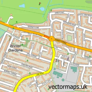
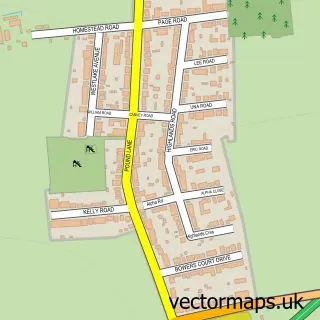
This Coryton street map is a detailed vector street map covering a 750m x 750m area. Select a larger area to create and download your own vector street map of Coryton.
The 750-metre map sample for Coryton covers 65 mapped buildings and approximately 9.6 km of road detail, of which 1 named road are named. The immediate area includes 2 MOT stations within 2 miles. To create a larger or custom map of Coryton, the map builder lets you define your own coverage area and download editable SVG, PDF and PNG files.
Create a larger editable map of Coryton
Choose any area you need and generate a high-quality vector map instantly. Perfect for print, planning, design, business and personal use.

This Coryton street map in Essex is available as downloadable SVG, PDF and PNG map files, or as a printed map for planning, business, display, education, local information and design work. You can also create a larger custom map area using the map selector.
What this Coryton map sample shows
Coryton lies within Thurrock (B) parish, part of Corringham And Fobbing ward in the Thurrock (B) local authority area. The postcode geography for this area includes the SS postcode area, the SS17 postcode district and the SS17 9 postcode sector. Residents fall under the Nhs Mid And South Essex Integrated Care Board for NHS services.
Local features near Coryton
Within 2 milesAmenities and services in and around Coryton.
Administrative and postcode information for Coryton
The local authority covering Coryton is Thurrock (B), within the county of Essex. The settlement lies within Corringham And Fobbing ward and Thurrock (B) civil parish. The SS17 postcode district and SS17 9 postcode sector serve the immediate area. NHS provision in the area is delivered through Mid And South Essex Nhs Foundation Trust.
Nearby street map samples around Coryton

More street maps in Essex
750 metre map area coverage
Boundary, postcode and point of interest information for the 750m x 750m rectangle centred on this sample map.
Boundaries containing map centre
Constituency: South Basildon and East Thurrock Co Const
District: Thurrock (B)
Icb: NHS Essex ICB
Police Force: essex
Postcode District: SS17
Postcode Sector: SS17 9
Ward: Corringham and Fobbing Ward
Nearby boundaries intersecting sample
No additional intersecting boundaries found.
Postcode coverage
POI category counts
Gas Station: 2
Contractor: 1
Electric Utility Provider: 1
Environmental Conservation Organization: 1
Information Technology Company: 1
Medical Service Organizations: 1
Retail: 1
Train Station: 1
Transportation: 1
Sample points of interest
- Mitsui Babcock Energy Services
- Coryton Power Station
- Briggs Marine Environmental Services
- BP
- Coryton Advanced Fuels
- ITF Tech Ltd.
- First Intervention Team
- Mammoth Tool Hire - Coryton - 0843 224 9666 - for Business
- Coryton railway station
- AAV Transport LTD
Create a larger editable map of Coryton
This sample shows only a 750 metre area. To create a larger map of Coryton, use our map builder to choose your own coverage area, add titles and download editable SVG, PDF and PNG files.
Create a custom map of Coryton