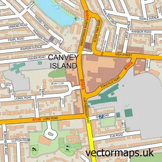
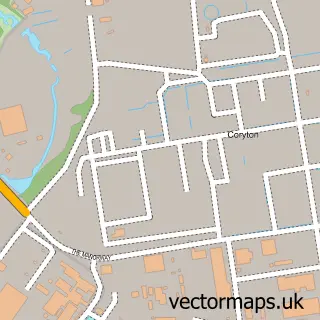
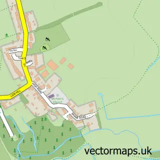
This Winter Gardens street map is a detailed vector street map covering a 750m x 750m area. Select a larger area to create and download your own vector street map of Winter Gardens.
The 750-metre map sample for Winter Gardens covers 457 mapped buildings and approximately 17.9 km of road detail, of which 46 named roads are named. The immediate area includes 2 schools, 9 GP surgeries within 2 miles and 7 MOT stations within 2 miles. The wider area around Winter Gardens features 1 food and drink venue. To create a larger or custom map of Winter Gardens, the map builder lets you define your own coverage area and download editable SVG, PDF and PNG files.
Create a larger editable map of Winter Gardens
Choose any area you need and generate a high-quality vector map instantly. Perfect for print, planning, design, business and personal use.

This Winter Gardens street map in Essex is available as downloadable SVG, PDF and PNG map files, or as a printed map for planning, business, display, education, local information and design work. You can also create a larger custom map area using the map selector.
What this Winter Gardens map sample shows
Winter Gardens lies within Canvey Island Cp parish, part of Canvey Island South ward in the Castle Point District (B) local authority area. The postcode geography for this area includes the SS postcode area, the SS8 postcode district and the SS8 7 postcode sector. Residents fall under the Nhs Mid And South Essex Integrated Care Board for NHS services.
Local features near Winter Gardens
Within 2 milesAmenities and services in and around Winter Gardens.
Administrative and postcode information for Winter Gardens
The local authority covering Winter Gardens is Castle Point District (B), within the county of Essex. The settlement lies within Canvey Island South ward and Canvey Island Cp civil parish. The SS8 postcode district and SS8 7 postcode sector serve the immediate area. NHS provision in the area is delivered through Mid And South Essex Nhs Foundation Trust.
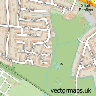
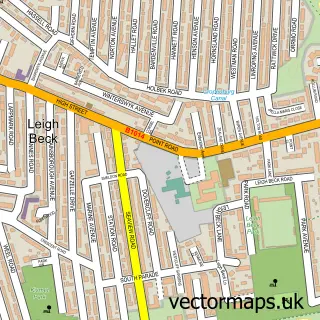
Nearby street map samples around Winter Gardens

More street maps in Essex
750 metre map area coverage
Boundary, postcode and point of interest information for the 750m x 750m rectangle centred on this sample map.
Boundaries containing map centre
Constituency: Castle Point Boro Const
County: Essex County
District: Castle Point District (B)
Icb: NHS Essex ICB
Parish: Canvey Island CP
Police Force: essex
Postcode District: SS8
Postcode Sector: SS8 9
Ward: Canvey Island Winter Gardens Ward
Nearby boundaries intersecting sample
No additional intersecting boundaries found.
Postcode coverage
POI category counts
Elementary School: 4
Gas Station: 3
Package Locker: 3
Electrician: 2
Post Office: 2
Rental Kiosks: 2
Scout Hall: 2
Advertising Agency: 1
Airport Shuttles: 1
Anglican Church: 1
Sample points of interest
- Pro-Tech Designs
- R & S Private Hire
- St Katherine's Church in the School
- MFG - Castle Point (MRH)
- aceplumbers.com
- Startright Mobile Mechanic
- Winter Gardens Baptist Church
- Amec Plumbing & Heating
- Oasis Gardening Services
- Lotto Street Management Solutions
- All Occasions Caterers
- Foundation Faith Church
Create a larger editable map of Winter Gardens
This sample shows only a 750 metre area. To create a larger map of Winter Gardens, use our map builder to choose your own coverage area, add titles and download editable SVG, PDF and PNG files.
Create a custom map of Winter Gardens