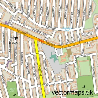
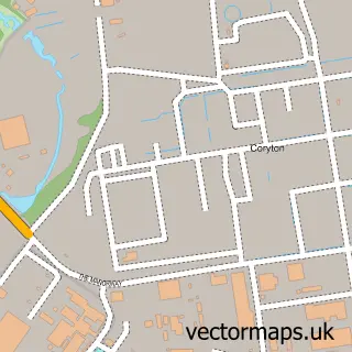
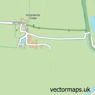
This Canvey Island street map is a detailed vector street map covering a 750m x 750m area. Select a larger area to create and download your own vector street map of Canvey Island.
The 750-metre map sample for Canvey Island covers 465 mapped buildings and approximately 20.2 km of road detail, of which 45 named roads are named. The immediate area includes 1 primary school and 1 secondary school, 3 GP surgeries, with 7 within 2 miles, 1 pub and 1 MOT station, with 7 within 2 miles. The wider area around Canvey Island features 3 tourism points of interest, 12 food and drink venues and 2 hotels. To create a larger or custom map of Canvey Island, the map builder lets you define your own coverage area and download editable SVG, PDF and PNG files.
Create a larger editable map of Canvey Island
Choose any area you need and generate a high-quality vector map instantly. Perfect for print, planning, design, business and personal use.

This Canvey Island street map in Essex is available as downloadable SVG, PDF and PNG map files, or as a printed map for planning, business, display, education, local information and design work. You can also create a larger custom map area using the map selector.
What this Canvey Island map sample shows
Canvey Island lies within Canvey Island Cp parish, part of Canvey Island South ward in the Castle Point District (B) local authority area. The postcode geography for this area includes the SS postcode area, the SS8 postcode district and the SS8 7 postcode sector. Residents fall under the Nhs Mid And South Essex Integrated Care Board for NHS services.
Local features near Canvey Island
Within 2 milesAmenities and services in and around Canvey Island.
Administrative and postcode information for Canvey Island
Canvey Island lies within Canvey Island Cp parish, part of Canvey Island South ward in the Castle Point District (B) local authority area. The postcode geography for this area includes the SS postcode area, the SS8 postcode district and the SS8 7 postcode sector. Residents fall under the Nhs Mid And South Essex Integrated Care Board for NHS services.
Nearby street map samples around Canvey Island

More street maps in Essex
750 metre map area coverage
Boundary, postcode and point of interest information for the 750m x 750m rectangle centred on this sample map.
Boundaries containing map centre
Constituency: Castle Point Boro Const
County: Essex County
District: Castle Point District (B)
Icb: NHS Essex ICB
Parish: Canvey Island CP
Police Force: essex
Postcode District: SS8
Postcode Sector: SS8 7
Ward: Canvey Island South Ward
Nearby boundaries intersecting sample
Postcode Sector: SS8 0, SS8 8, SS8 9
Ward: Canvey Island Central Ward, Canvey Island North Ward
Postcode coverage
POI category counts
Beauty Salon: 10
Bakery: 8
Hair Salon: 8
Real Estate Agent: 8
Cafe: 6
Clothing Store: 6
Nail Salon: 6
Professional Services: 6
Barber: 5
Building Supply Store: 5
Sample points of interest
- MSB & Co. Canvey Island
- Maynard Heady
- Design 4 Print
- Star Amusements
- Sense
- Hills Electrical
- Bbvr
- Contour Architectural Designs
- Craftywafty
- Kushi Canvey Island
- Novus Care - Canvey Island, Essex
- Autocare
Create a larger editable map of Canvey Island
This sample shows only a 750 metre area. To create a larger map of Canvey Island, use our map builder to choose your own coverage area, add titles and download editable SVG, PDF and PNG files.
Create a custom map of Canvey Island