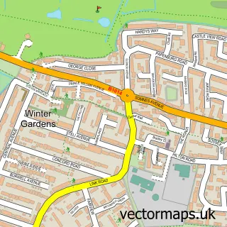
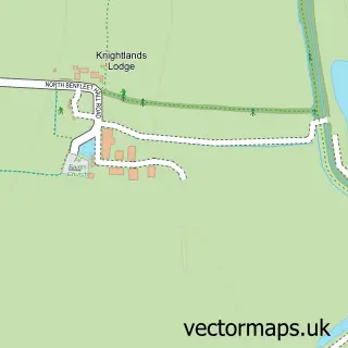
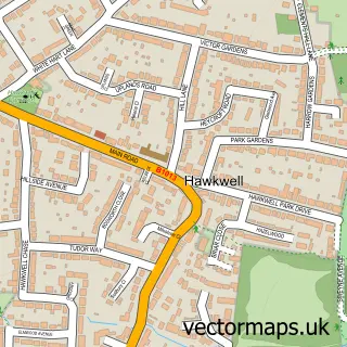
This Hadleigh street map is a detailed vector street map covering a 750m x 750m area. Select a larger area to create and download your own vector street map of Hadleigh.
The 750-metre map sample for Hadleigh covers 501 mapped buildings and approximately 17.6 km of road detail, of which 38 named roads are named. The immediate area includes 1 school, 1 GP surgery, with 4 within 2 miles, 2 pubs and 1 MOT station, with 16 within 2 miles. The wider area around Hadleigh features 4 tourism points of interest and 12 food and drink venues. To create a larger or custom map of Hadleigh, the map builder lets you define your own coverage area and download editable SVG, PDF and PNG files.
Create a larger editable map of Hadleigh
Choose any area you need and generate a high-quality vector map instantly. Perfect for print, planning, design, business and personal use.

This Hadleigh street map in Essex is available as downloadable SVG, PDF and PNG map files, or as a printed map for planning, business, display, education, local information and design work. You can also create a larger custom map area using the map selector.
What this Hadleigh map sample shows
Hadleigh lies within Essex County parish, part of St James ward in the Castle Point District (B) local authority area. The postcode geography for this area includes the SS postcode area, the SS7 postcode district and the SS7 2 postcode sector. Residents fall under the Nhs Mid And South Essex Integrated Care Board for NHS services.
Local features near Hadleigh
Within 2 milesAmenities and services in and around Hadleigh.
Administrative and postcode information for Hadleigh
Hadleigh lies within Essex County parish, part of St James ward in the Castle Point District (B) local authority area. The postcode geography for this area includes the SS postcode area, the SS7 postcode district and the SS7 2 postcode sector. Residents fall under the Nhs Mid And South Essex Integrated Care Board for NHS services.
Nearby street map samples around Hadleigh

More street maps in Essex
750 metre map area coverage
Boundary, postcode and point of interest information for the 750m x 750m rectangle centred on this sample map.
Boundaries containing map centre
Constituency: Castle Point Boro Const
County: Essex County
District: Castle Point District (B)
Icb: NHS Essex ICB
Police Force: essex
Postcode District: SS7
Postcode Sector: SS7 2
Ward: Hadleigh St. James Ward, St. Michael's Ward
Nearby boundaries intersecting sample
No additional intersecting boundaries found.
Postcode coverage
POI category counts
Beauty Salon: 10
Cafe: 7
Car Dealer: 7
Accountant: 6
Building Supply Store: 5
Hair Salon: 5
Real Estate Agent: 5
Retail: 5
Banks: 4
Barber: 4
Sample points of interest
- Antony J. Holdsworth & Co
- Booksure Accounting Limited
- E. H. Taylors LLP
- KFH Accounting Ltd
- Santry Davis
- Thompson Accountancy Services
- Mega Pleasure
- 76 Digital Marketing
- S & T Private Hire Ltd.
- Hadleigh Osteopathy
- Hadleigh: St James the Less
- St James the Less
Create a larger editable map of Hadleigh
This sample shows only a 750 metre area. To create a larger map of Hadleigh, use our map builder to choose your own coverage area, add titles and download editable SVG, PDF and PNG files.
Create a custom map of Hadleigh