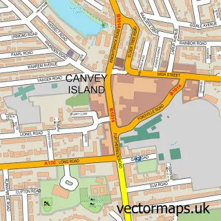
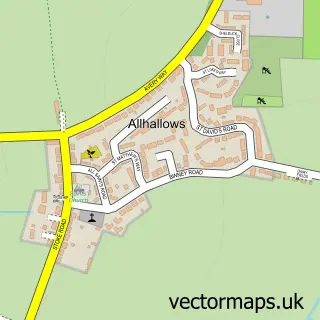
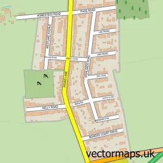
This Leigh Beck street map is a detailed vector street map covering a 750m x 750m area. Select a larger area to create and download your own vector street map of Leigh Beck.
The 750-metre map sample for Leigh Beck covers 655 mapped buildings and approximately 26.6 km of road detail, of which 60 named roads are named. The immediate area includes 2 schools, 5 GP surgeries within 2 miles and 2 MOT stations within 2 miles. The wider area around Leigh Beck features 3 tourism points of interest and 1 food and drink venue. To create a larger or custom map of Leigh Beck, the map builder lets you define your own coverage area and download editable SVG, PDF and PNG files.
Create a larger editable map of Leigh Beck
Choose any area you need and generate a high-quality vector map instantly. Perfect for print, planning, design, business and personal use.

This Leigh Beck street map in Essex is available as downloadable SVG, PDF and PNG map files, or as a printed map for planning, business, display, education, local information and design work. You can also create a larger custom map area using the map selector.
What this Leigh Beck map sample shows
Leigh Beck lies within Canvey Island Cp parish, part of Canvey Island East ward in the Castle Point District (B) local authority area. The postcode geography for this area includes the SS postcode area, the SS8 postcode district and the SS8 7 postcode sector. Residents fall under the Nhs Mid And South Essex Integrated Care Board for NHS services.
Local features near Leigh Beck
Within 2 milesAmenities and services in and around Leigh Beck.
Administrative and postcode information for Leigh Beck
The local authority covering Leigh Beck is Castle Point District (B), within the county of Essex. The settlement lies within Canvey Island East ward and Canvey Island Cp civil parish. The SS8 postcode district and SS8 7 postcode sector serve the immediate area. NHS provision in the area is delivered through Mid And South Essex Nhs Foundation Trust.
Nearby street map samples around Leigh Beck

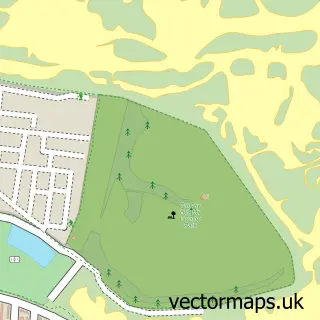
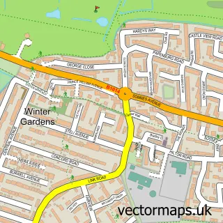
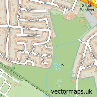
More street maps in Essex
750 metre map area coverage
Boundary, postcode and point of interest information for the 750m x 750m rectangle centred on this sample map.
Boundaries containing map centre
Constituency: Castle Point Boro Const
County: Essex County
District: Castle Point District (B)
Icb: NHS Essex ICB
Parish: Canvey Island CP
Police Force: essex
Postcode District: SS8
Postcode Sector: SS8 7
Ward: Canvey Island East Ward
Nearby boundaries intersecting sample
Postcode Sector: SS8 8
Postcode coverage
POI category counts
Beauty Salon: 3
Building Contractor: 2
Building Supply Store: 2
Church Cathedral: 2
Sports Club And League: 2
Advertising Agency: 1
Anglican Church: 1
Atms: 1
Baptist Church: 1
Bar: 1
Sample points of interest
- Epic Marketing Services
- St Anne
- ATM (Post Office)
- Canvey Island Baptist Church
- Admiral Jellicoe
- Shell Beach Canvey Island
- Bright Tanning & Beauty
- HairbyVeronika
- Love Beauty Limited
- Admiral Jellicoe
- Kevin Hughes
- Right Door
Create a larger editable map of Leigh Beck
This sample shows only a 750 metre area. To create a larger map of Leigh Beck, use our map builder to choose your own coverage area, add titles and download editable SVG, PDF and PNG files.
Create a custom map of Leigh Beck