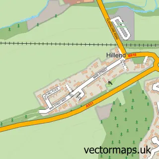
This Hill of Beath street map is a detailed vector street map covering a 750m x 750m area. Select a larger area to create and download your own vector street map of Hill of Beath.
The 750-metre map sample for Hill of Beath covers 198 mapped buildings and approximately 12.4 km of road detail, of which 13 named roads are named. The immediate area includes 2 GP surgeries within 2 miles and 8 MOT stations within 2 miles. To create a larger or custom map of Hill of Beath, the map builder lets you define your own coverage area and download editable SVG, PDF and PNG files.
Create a larger editable map of Hill of Beath
Choose any area you need and generate a high-quality vector map instantly. Perfect for print, planning, design, business and personal use.

This Hill of Beath street map in Fife is available as downloadable SVG, PDF and PNG map files, or as a printed map for planning, business, display, education, local information and design work. You can also create a larger custom map area using the map selector.
What this Hill of Beath map sample shows
Hill of Beath lies within Fife parish, part of Cowdenbeath ward in the Fife local authority area. The postcode geography for this area includes the KY postcode area, the KY4 postcode district and the KY4 8 postcode sector. Residents fall under the Fife for NHS services.
Local features near Hill of Beath
Within 2 milesAmenities and services in and around Hill of Beath.
Administrative and postcode information for Hill of Beath
The local authority covering Hill of Beath is Fife, within the county of Fife. The settlement lies within Cowdenbeath ward and Fife civil parish. The KY4 postcode district and KY4 8 postcode sector serve the immediate area. NHS provision in the area is delivered through Fife.
Nearby street map samples around Hill of Beath
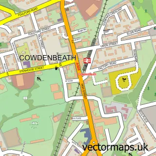

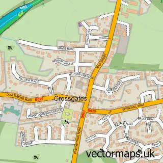
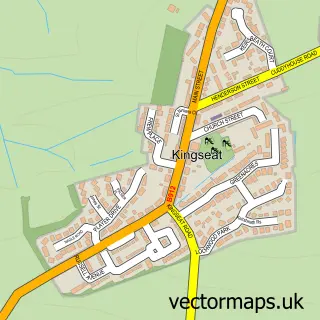
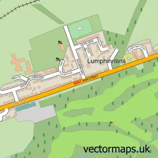
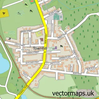
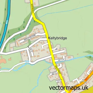
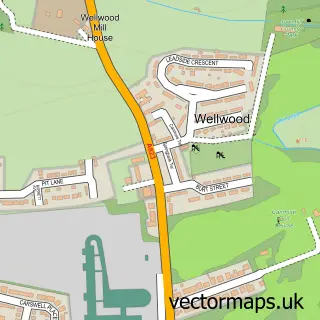
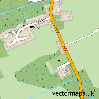
More street maps in Fife
750 metre map area coverage
Boundary, postcode and point of interest information for the 750m x 750m rectangle centred on this sample map.
Boundaries containing map centre
Constituency: Cowdenbeath and Kirkcaldy Co Const
District: Fife
Icb: Fife
Postcode District: KY4
Postcode Sector: KY4 8
Ward: Cowdenbeath Ward
Nearby boundaries intersecting sample
Postcode District: KY12
Postcode Sector: KY12 0, KY4 9
Postcode coverage
POI category counts
Courier And Delivery Services: 2
Atms: 1
Carpet Store: 1
Community Center: 1
Community Services Non Profits: 1
Driving School: 1
Fast Food Restaurant: 1
Hair Salon: 1
Post Office: 1
Professional Services: 1
Sample points of interest
- PayPoint
- Cutting Edge Carpets
- Hill Of Beath Community Centre
- Dalgety Bay Astronomy Club
- Evri ParcelShop
- Evri ParcelShop
- Changing Lanes Driving School
- Peking House
- Jenna's Hair and Beauty
- Hill of Beath Post Office
- Hill of Beath Ex Service Memorial Club
- Hill Of Beath Post Office
Create a larger editable map of Hill of Beath
This sample shows only a 750 metre area. To create a larger map of Hill of Beath, use our map builder to choose your own coverage area, add titles and download editable SVG, PDF and PNG files.
Create a custom map of Hill of Beath