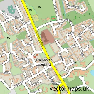
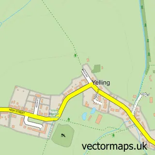
This Hilton street map is a detailed vector street map covering a 750m x 750m area. Select a larger area to create and download your own vector street map of Hilton.
The 750-metre map sample for Hilton covers 348 mapped buildings and approximately 12.3 km of road detail, of which 25 named roads are named. The immediate area includes 1 GP surgery within 2 miles and 1 pub. The wider area around Hilton features 2 food and drink venues. To create a larger or custom map of Hilton, the map builder lets you define your own coverage area and download editable SVG, PDF and PNG files.
Create a larger editable map of Hilton
Choose any area you need and generate a high-quality vector map instantly. Perfect for print, planning, design, business and personal use.

This Hilton street map in Cambridgeshire is available as downloadable SVG, PDF and PNG map files, or as a printed map for planning, business, display, education, local information and design work. You can also create a larger custom map area using the map selector.
What this Hilton map sample shows
Hilton lies within Hilton Cp parish, part of Fenstanton ward in the Huntingdonshire District local authority area. The postcode geography for this area includes the PE postcode area, the PE28 postcode district and the PE28 9 postcode sector. Residents fall under the Nhs Cambridgeshire And Peterborough Integrated Care Board for NHS services.
Local features near Hilton
Within 2 milesAmenities and services in and around Hilton.
Administrative and postcode information for Hilton
The local authority covering Hilton is Huntingdonshire District, within the county of Cambridgeshire. The settlement lies within Fenstanton ward and Hilton Cp civil parish. The PE28 postcode district and PE28 9 postcode sector serve the immediate area. NHS provision in the area is delivered through North West Anglia Nhs Foundation Trust.
Nearby street map samples around Hilton

More street maps in Cambridgeshire
750 metre map area coverage
Boundary, postcode and point of interest information for the 750m x 750m rectangle centred on this sample map.
Boundaries containing map centre
Constituency: St. Neots and Mid Cambridgeshire Co Const
County: Cambridgeshire County
District: Huntingdonshire District
Icb: NHS Central East ICB
Parish: Hilton CP
Police Force: cambridgeshire
Postcode District: PE28
Postcode Sector: PE28 9
Ward: Fenstanton Ward
Nearby boundaries intersecting sample
No additional intersecting boundaries found.
Postcode coverage
POI category counts
It Service And Computer Repair: 3
Flooring Contractors: 2
Anglican Church: 1
Bike Repair Maintenance: 1
Business Consulting: 1
Business Management Services: 1
Carpenter: 1
Coffee Shop: 1
Community Center: 1
Cupcake Shop: 1
Sample points of interest
- St Mary Magdalene
- CYCALL Mobile Bicycle Repairs
- The Mercantile Group
- Zig Zag Music Productions
- New Farm Cabinet Makers
- Wildcard Coffee Roasters
- Hilton Village Hall, Cambs
- Mill Hill Couture Cakes
- Fondant Flourish Celebration Cakes
- Hilton Day Nursery
- VA Mortgages
- R D B Flooring
Create a larger editable map of Hilton
This sample shows only a 750 metre area. To create a larger map of Hilton, use our map builder to choose your own coverage area, add titles and download editable SVG, PDF and PNG files.
Create a custom map of Hilton