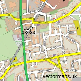
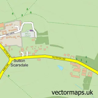
This Holmewood street map is a detailed vector street map covering a 750m x 750m area. Select a larger area to create and download your own vector street map of Holmewood.
The 750-metre map sample for Holmewood covers 284 mapped buildings and approximately 21.6 km of road detail, of which 26 named roads are named. The immediate area includes 2 GP surgeries within 2 miles and 4 MOT stations within 2 miles. The wider area around Holmewood features 2 tourism points of interest and 4 food and drink venues. To create a larger or custom map of Holmewood, the map builder lets you define your own coverage area and download editable SVG, PDF and PNG files.
Create a larger editable map of Holmewood
Choose any area you need and generate a high-quality vector map instantly. Perfect for print, planning, design, business and personal use.

This Holmewood street map in Derbyshire is available as downloadable SVG, PDF and PNG map files, or as a printed map for planning, business, display, education, local information and design work. You can also create a larger custom map area using the map selector.
What this Holmewood map sample shows
Holmewood lies within North Wingfield Cp parish, part of Holmewood & Heath ward in the North East Derbyshire District local authority area. The postcode geography for this area includes the S postcode area, the S42 postcode district and the S42 5 postcode sector. Residents fall under the Nhs Derby And Derbyshire Integrated Care Board for NHS services.
Local features near Holmewood
Within 2 milesAmenities and services in and around Holmewood.
Administrative and postcode information for Holmewood
Holmewood lies within North Wingfield Cp parish, part of Holmewood & Heath ward in the North East Derbyshire District local authority area. The postcode geography for this area includes the S postcode area, the S42 postcode district and the S42 5 postcode sector. Residents fall under the Nhs Derby And Derbyshire Integrated Care Board for NHS services.
Nearby street map samples around Holmewood

More street maps in Derbyshire
750 metre map area coverage
Boundary, postcode and point of interest information for the 750m x 750m rectangle centred on this sample map.
Boundaries containing map centre
Constituency: Bolsover Co Const
County: Derbyshire County
District: North East Derbyshire District
Icb: NHS Derby and Derbyshire ICB
Parish: Heath and Holmewood CP
Police Force: derbyshire
Postcode District: S42
Postcode Sector: S42 5
Ward: Holmewood & Heath Ward
Nearby boundaries intersecting sample
Postcode District: S44
Postcode Sector: S44 5
Postcode coverage
POI category counts
Building Supply Store: 8
Professional Services: 4
Automotive Repair: 3
Restaurant: 3
Retail: 3
Atms: 2
Bar: 2
Beauty And Spa: 2
Engineering Services: 2
Home Health Care: 2
Sample points of interest
- Aspire Accountancy Services Ltd.
- St Albans Centre
- Magbroach UK Ltd
- Junction 29 Aquatics
- Economy Fabrics
- Hardwick Close
- ATM (Post Office)
- PayPoint
- Advance Accident Repairs
- Cb's Aerials
- Holmewood Service Centre
- Holmewood autocare
Create a larger editable map of Holmewood
This sample shows only a 750 metre area. To create a larger map of Holmewood, use our map builder to choose your own coverage area, add titles and download editable SVG, PDF and PNG files.
Create a custom map of Holmewood