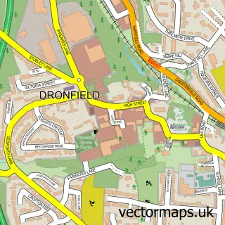
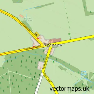
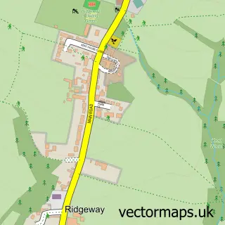
This Sheffield street map is a detailed vector street map covering a 750m x 750m area. Select a larger area to create and download your own vector street map of Sheffield.
The 750-metre map sample for Sheffield covers 143 mapped buildings and approximately 41.2 km of road detail, of which 84 named roads are named. The immediate area includes 2 schools, 3 railway stations, 2 GP surgeries, with 27 within 2 miles and 44 pubs among other local services. The wider area around Sheffield features 27 tourism points of interest, 130 food and drink venues and 24 hotels. To create a larger or custom map of Sheffield, the map builder lets you define your own coverage area and download editable SVG, PDF and PNG files.
Create a larger editable map of Sheffield
Choose any area you need and generate a high-quality vector map instantly. Perfect for print, planning, design, business and personal use.

This Sheffield street map in South Yorkshire is available as downloadable SVG, PDF and PNG map files, or as a printed map for planning, business, display, education, local information and design work. You can also create a larger custom map area using the map selector.
What this Sheffield map sample shows
Sheffield lies within Sheffield District (B) parish, part of Park And Arbourthorne ward in the Sheffield District (B) local authority area. The postcode geography for this area includes the S postcode area, the S12 postcode district and the S12 2 postcode sector. Residents fall under the Nhs South Yorkshire Integrated Care Board for NHS services.
Local features near Sheffield
Within 2 milesAmenities and services in and around Sheffield.
Administrative and postcode information for Sheffield
The local authority covering Sheffield is Sheffield District (B), within the county of South Yorkshire. The settlement lies within Park And Arbourthorne ward and Sheffield District (B) civil parish. The S12 postcode district and S12 2 postcode sector serve the immediate area. NHS provision in the area is delivered through Sheffield Teaching Hospitals Nhs Foundation Trust.
Nearby street map samples around Sheffield
More street maps in South Yorkshire
750 metre map area coverage
Boundary, postcode and point of interest information for the 750m x 750m rectangle centred on this sample map.
Boundaries containing map centre
Constituency: Sheffield Central Boro Const
District: Sheffield District (B)
Icb: NHS South Yorkshire ICB
Police Force: south yorkshire
Postcode District: S1
Postcode Sector: S1 2
Ward: City Ward
Nearby boundaries intersecting sample
Postcode District: S3
Postcode Sector: S1 4, S3 8
Postcode coverage
POI category counts
Bar: 45
Cafe: 44
Employment Agencies: 44
Professional Services: 44
Pub: 44
Clothing Store: 29
Dance Club: 25
Charity Organization: 24
Hotel: 24
Beauty Salon: 23
Sample points of interest
- Birchwood and Co Case Management
- Bailey Street
- King's Chambers
- Pauls
- Phoenix Court Sheffield Student Accommodation
- Prestige Student Living Straits Manor
- Sellers Wheel Apartments
- The Paper Works
- Eaves and Co
- Tax Accountant Sheffield
- Sheffield Hallam University Sport
- Sheffield 1 Acupuncture
Create a larger editable map of Sheffield
This sample shows only a 750 metre area. To create a larger map of Sheffield, use our map builder to choose your own coverage area, add titles and download editable SVG, PDF and PNG files.
Create a custom map of Sheffield