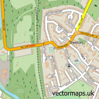
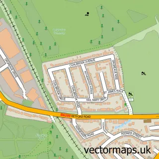
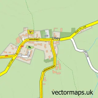
This Catcliffe street map is a detailed vector street map covering a 750m x 750m area. Select a larger area to create and download your own vector street map of Catcliffe.
The 750-metre map sample for Catcliffe covers 300 mapped buildings and approximately 23.1 km of road detail, of which 32 named roads are named. The immediate area includes 1 school, 6 GP surgeries within 2 miles and 15 MOT stations within 2 miles. The wider area around Catcliffe features 1 tourism point of interest and 2 food and drink venues. To create a larger or custom map of Catcliffe, the map builder lets you define your own coverage area and download editable SVG, PDF and PNG files.
Create a larger editable map of Catcliffe
Choose any area you need and generate a high-quality vector map instantly. Perfect for print, planning, design, business and personal use.

This Catcliffe street map in South Yorkshire is available as downloadable SVG, PDF and PNG map files, or as a printed map for planning, business, display, education, local information and design work. You can also create a larger custom map area using the map selector.
What this Catcliffe map sample shows
Catcliffe lies within Catcliffe Cp parish, part of Brinsworth And Catcliffe ward in the Rotherham District (B) local authority area. The postcode geography for this area includes the S postcode area, the S60 postcode district and the S60 5 postcode sector. Residents fall under the Nhs South Yorkshire Integrated Care Board for NHS services.
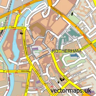
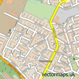
Local features near Catcliffe
Within 2 milesAmenities and services in and around Catcliffe.
Administrative and postcode information for Catcliffe
Catcliffe lies within Catcliffe Cp parish, part of Brinsworth And Catcliffe ward in the Rotherham District (B) local authority area. The postcode geography for this area includes the S postcode area, the S60 postcode district and the S60 5 postcode sector. Residents fall under the Nhs South Yorkshire Integrated Care Board for NHS services.
Nearby street map samples around Catcliffe

More street maps in South Yorkshire
750 metre map area coverage
Boundary, postcode and point of interest information for the 750m x 750m rectangle centred on this sample map.
Boundaries containing map centre
Constituency: Rotherham Boro Const
District: Rotherham District (B)
Icb: NHS South Yorkshire ICB
Parish: Catcliffe CP
Police Force: south yorkshire
Postcode District: S60
Postcode Sector: S60 5
Ward: Rother Vale Ward
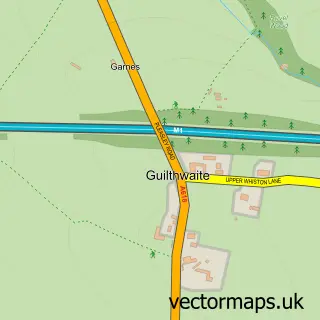
Nearby boundaries intersecting sample
Parish: Treeton CP
Postcode coverage
POI category counts
Barber: 3
Automotive Repair: 2
Beauty And Spa: 2
Beauty Salon: 2
Business Management Services: 2
Community Center: 2
Convenience Store: 2
Education: 2
Event Technology Service: 2
Professional Services: 2
Sample points of interest
- St Mary's Catcliffe
- Mesters Construction
- PayPoint
- Phoenix Motor Depot Rotherham
- Car Centre
- Catcliffe Garage
- Total Caravan Services
- Ace of Fadez
- Bash Barber
- The Barbershop & Beauty Room Catcliffe
- Jays Beauty Bar
- Zoi Skincare and Aesthetics
Create a larger editable map of Catcliffe
This sample shows only a 750 metre area. To create a larger map of Catcliffe, use our map builder to choose your own coverage area, add titles and download editable SVG, PDF and PNG files.
Create a custom map of Catcliffe