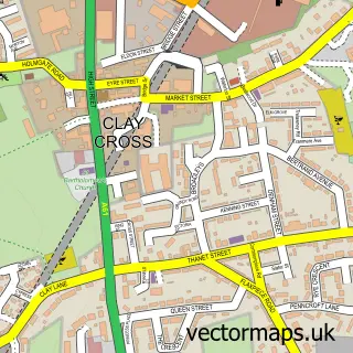
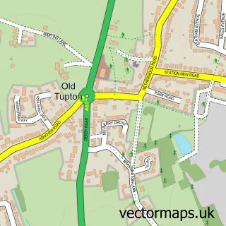
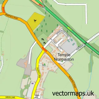
This North Wingfield street map is a detailed vector street map covering a 750m x 750m area. Select a larger area to create and download your own vector street map of North Wingfield.
The 750-metre map sample for North Wingfield covers 403 mapped buildings and approximately 17.7 km of road detail, of which 27 named roads are named. The immediate area includes 1 GP surgery, with 4 within 2 miles, 1 pub and 1 MOT station, with 10 within 2 miles. The wider area around North Wingfield features 1 tourism point of interest and 3 food and drink venues. To create a larger or custom map of North Wingfield, the map builder lets you define your own coverage area and download editable SVG, PDF and PNG files.
Create a larger editable map of North Wingfield
Choose any area you need and generate a high-quality vector map instantly. Perfect for print, planning, design, business and personal use.

This North Wingfield street map in Derbyshire is available as downloadable SVG, PDF and PNG map files, or as a printed map for planning, business, display, education, local information and design work. You can also create a larger custom map area using the map selector.
What this North Wingfield map sample shows
North Wingfield lies within North Wingfield Cp parish, part of North Wingfield Central ward in the North East Derbyshire District local authority area. The postcode geography for this area includes the S postcode area, the S42 postcode district and the S42 5 postcode sector. Residents fall under the Nhs Derby And Derbyshire Integrated Care Board for NHS services.
Local features near North Wingfield
Within 2 milesAmenities and services in and around North Wingfield.
Administrative and postcode information for North Wingfield
The local authority covering North Wingfield is North East Derbyshire District, within the county of Derbyshire. The settlement lies within North Wingfield Central ward and North Wingfield Cp civil parish. The S42 postcode district and S42 5 postcode sector serve the immediate area. NHS provision in the area is delivered through Chesterfield Royal Hospital Nhs Foundation Trust.
Nearby street map samples around North Wingfield

More street maps in Derbyshire
750 metre map area coverage
Boundary, postcode and point of interest information for the 750m x 750m rectangle centred on this sample map.
Boundaries containing map centre
Constituency: North East Derbyshire Co Const
County: Derbyshire County
District: North East Derbyshire District
Icb: NHS Derby and Derbyshire ICB
Parish: North Wingfield CP
Police Force: derbyshire
Postcode District: S42
Postcode Sector: S42 5
Ward: North Wingfield Central Ward
Nearby boundaries intersecting sample
No additional intersecting boundaries found.
Postcode coverage
POI category counts
Beauty Salon: 5
Convenience Store: 4
Coffee Shop: 2
Hair Salon: 2
Laundry Services: 2
Package Locker: 2
Pharmaceutical Products Wholesaler: 2
Telecommunications: 2
Advertising Agency: 1
Automotive Repair: 1
Sample points of interest
- The Shoppers Guide
- J W Richards and Sons
- Spread Eagle
- Baran's Barber S42
- Vanilla Spa
- A Shed Of Beauty
- Influx Hair & Beauty
- Le chic beauty salon
- Sparkle & Glitz
- The Lash Brow and Hair Extension Clinic
- Cleantec Carpet & Upholstery Cleaning
- Jolivers Childrenswear
Create a larger editable map of North Wingfield
This sample shows only a 750 metre area. To create a larger map of North Wingfield, use our map builder to choose your own coverage area, add titles and download editable SVG, PDF and PNG files.
Create a custom map of North Wingfield