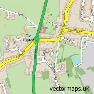
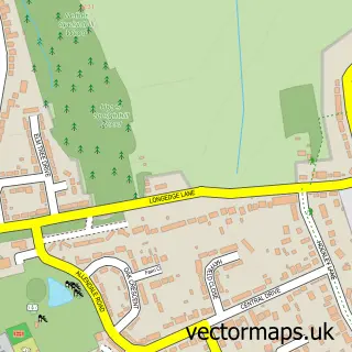
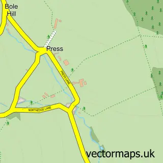
This New Tupton street map is a detailed vector street map covering a 750m x 750m area. Select a larger area to create and download your own vector street map of New Tupton.
The 750-metre map sample for New Tupton covers 328 mapped buildings and approximately 16.9 km of road detail, of which 22 named roads are named. The immediate area includes 1 school, 5 GP surgeries within 2 miles, 2 pubs and 1 MOT station, with 12 within 2 miles. The wider area around New Tupton features 4 food and drink venues. To create a larger or custom map of New Tupton, the map builder lets you define your own coverage area and download editable SVG, PDF and PNG files.
Create a larger editable map of New Tupton
Choose any area you need and generate a high-quality vector map instantly. Perfect for print, planning, design, business and personal use.

This New Tupton street map in Derbyshire is available as downloadable SVG, PDF and PNG map files, or as a printed map for planning, business, display, education, local information and design work. You can also create a larger custom map area using the map selector.
What this New Tupton map sample shows
New Tupton lies within Tupton Cp parish, part of Tupton ward in the North East Derbyshire District local authority area. The postcode geography for this area includes the S postcode area, the S42 postcode district and the S42 6 postcode sector. Residents fall under the Nhs Derby And Derbyshire Integrated Care Board for NHS services.
Local features near New Tupton
Within 2 milesAmenities and services in and around New Tupton.
Administrative and postcode information for New Tupton
The local authority covering New Tupton is North East Derbyshire District, within the county of Derbyshire. The settlement lies within Tupton ward and Tupton Cp civil parish. The S42 postcode district and S42 6 postcode sector serve the immediate area. NHS provision in the area is delivered through Chesterfield Royal Hospital Nhs Foundation Trust.
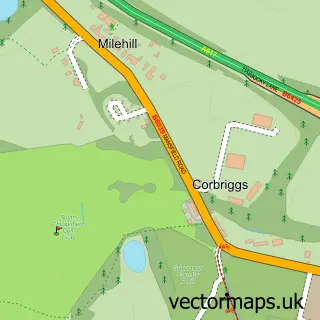
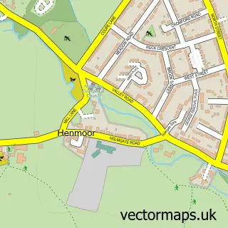
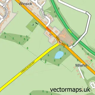
Nearby street map samples around New Tupton

More street maps in Derbyshire
750 metre map area coverage
Boundary, postcode and point of interest information for the 750m x 750m rectangle centred on this sample map.
Boundaries containing map centre
Constituency: North East Derbyshire Co Const
County: Derbyshire County
District: North East Derbyshire District
Icb: NHS Derby and Derbyshire ICB
Parish: Tupton CP
Police Force: derbyshire
Postcode District: S42
Postcode Sector: S42 6
Ward: Tupton Ward
Nearby boundaries intersecting sample
Parish: Wingerworth CP
Ward: Clay Cross North Ward, Wingerworth Ward
Postcode coverage
POI category counts
Beauty Salon: 3
Massage Therapy: 2
Pub: 2
Roofing: 2
Sports Club And League: 2
Anglican Church: 1
Arts And Entertainment: 1
Atms: 1
Automotive Repair: 1
Bar: 1
Sample points of interest
- St John's Tupton
- New Tupton
- Morrisons Daily - Chesterfield Nethermoor R, New Tupton
- Ward Street Garage
- Tupton Rufc
- A1 Nails & Skin Clinic - CACI Chesterfield
- Beehive by Charlotte
- Couture hair
- Post Office-New Tupton
- S42 Cafe
- TTS Car Sales
- Tupton Edge Centre
Create a larger editable map of New Tupton
This sample shows only a 750 metre area. To create a larger map of New Tupton, use our map builder to choose your own coverage area, add titles and download editable SVG, PDF and PNG files.
Create a custom map of New Tupton