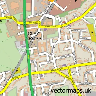
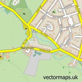
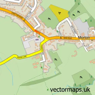
This Danesmoor street map is a detailed vector street map covering a 750m x 750m area. Select a larger area to create and download your own vector street map of Danesmoor.
The 750-metre map sample for Danesmoor covers 382 mapped buildings and approximately 20.8 km of road detail, of which 35 named roads are named. The immediate area includes 1 school, 4 GP surgeries within 2 miles, 1 pub and 10 MOT stations within 2 miles. The wider area around Danesmoor features 1 tourism point of interest, 2 food and drink venues and 1 campsite within 2 miles. To create a larger or custom map of Danesmoor, the map builder lets you define your own coverage area and download editable SVG, PDF and PNG files.
Create a larger editable map of Danesmoor
Choose any area you need and generate a high-quality vector map instantly. Perfect for print, planning, design, business and personal use.

This Danesmoor street map in Derbyshire is available as downloadable SVG, PDF and PNG map files, or as a printed map for planning, business, display, education, local information and design work. You can also create a larger custom map area using the map selector.
What this Danesmoor map sample shows
Danesmoor lies within Clay Cross Cp parish, part of Clay Cross South ward in the North East Derbyshire District local authority area. The postcode geography for this area includes the S postcode area, the S45 postcode district and the S45 9 postcode sector. Residents fall under the Nhs Derby And Derbyshire Integrated Care Board for NHS services.
Local features near Danesmoor
Within 2 milesAmenities and services in and around Danesmoor.
Administrative and postcode information for Danesmoor
Danesmoor lies within Clay Cross Cp parish, part of Clay Cross South ward in the North East Derbyshire District local authority area. The postcode geography for this area includes the S postcode area, the S45 postcode district and the S45 9 postcode sector. Residents fall under the Nhs Derby And Derbyshire Integrated Care Board for NHS services.
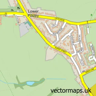
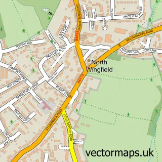
Nearby street map samples around Danesmoor

More street maps in Derbyshire
750 metre map area coverage
Boundary, postcode and point of interest information for the 750m x 750m rectangle centred on this sample map.
Boundaries containing map centre
Constituency: North East Derbyshire Co Const
County: Derbyshire County
District: North East Derbyshire District
Icb: NHS Derby and Derbyshire ICB
Parish: Clay Cross CP
Police Force: derbyshire
Postcode District: S45
Postcode Sector: S45 9
Ward: Clay Cross South Ward
Nearby boundaries intersecting sample
Constituency: Bolsover Co Const
Parish: Pilsley CP
Ward: Clay Cross North Ward, Pilsley & Morton Ward
Postcode coverage
POI category counts
Convenience Store: 3
Korean Grocery Store: 2
Police Department: 2
Professional Services: 2
Anglican Church: 1
Arts And Crafts: 1
Arts And Entertainment: 1
Atms: 1
Boxing Class: 1
Building Supply Store: 1
Sample points of interest
- St Barnabas Church and Centre
- Knit Sew Crafty
- The Doodle Bug
- ATM (Post Office)
- Chesterfield Amateur Boxing Club
- M & M Timber & Building Supplies
- Worcester Bosch Manufacturing Plant
- Card Factory
- The Jackson Bakers
- Sharley Park Community School
- St. Barnabas Community Centre
- Danesmoor Mini Market
Create a larger editable map of Danesmoor
This sample shows only a 750 metre area. To create a larger map of Danesmoor, use our map builder to choose your own coverage area, add titles and download editable SVG, PDF and PNG files.
Create a custom map of Danesmoor