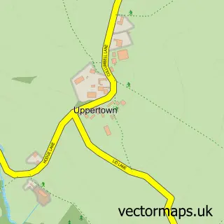
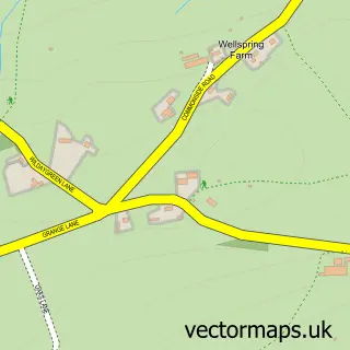
This Holymoorside street map is a detailed vector street map covering a 750m x 750m area. Select a larger area to create and download your own vector street map of Holymoorside.
The 750-metre map sample for Holymoorside covers 305 mapped buildings and approximately 14.9 km of road detail, of which 19 named roads are named. The immediate area includes 1 GP surgery within 2 miles, 2 pubs and 3 MOT stations within 2 miles. The wider area around Holymoorside features 1 tourism point of interest, 2 food and drink venues and 1 hotel. To create a larger or custom map of Holymoorside, the map builder lets you define your own coverage area and download editable SVG, PDF and PNG files.
Create a larger editable map of Holymoorside
Choose any area you need and generate a high-quality vector map instantly. Perfect for print, planning, design, business and personal use.

This Holymoorside street map in Derbyshire is available as downloadable SVG, PDF and PNG map files, or as a printed map for planning, business, display, education, local information and design work. You can also create a larger custom map area using the map selector.
What this Holymoorside map sample shows
Holymoorside lies within Holymoorside And Walton Cp parish, part of Brampton & Walton ward in the North East Derbyshire District local authority area. The postcode geography for this area includes the S postcode area, the S42 postcode district and the S42 7 postcode sector. Residents fall under the Nhs Derby And Derbyshire Integrated Care Board for NHS services.
Local features near Holymoorside
Within 2 milesAmenities and services in and around Holymoorside.
Administrative and postcode information for Holymoorside
The local authority covering Holymoorside is North East Derbyshire District, within the county of Derbyshire. The settlement lies within Brampton & Walton ward and Holymoorside And Walton Cp civil parish. The S42 postcode district and S42 7 postcode sector serve the immediate area. NHS provision in the area is delivered through Chesterfield Royal Hospital Nhs Foundation Trust.
Nearby street map samples around Holymoorside

More street maps in Derbyshire
750 metre map area coverage
Boundary, postcode and point of interest information for the 750m x 750m rectangle centred on this sample map.
Boundaries containing map centre
Constituency: North East Derbyshire Co Const
County: Derbyshire County
District: North East Derbyshire District
Icb: NHS Derby and Derbyshire ICB
Parish: Holymoorside and Walton CP
Police Force: derbyshire
Postcode District: S42
Postcode Sector: S42 7
Ward: Brampton & Walton Ward
Nearby boundaries intersecting sample
No additional intersecting boundaries found.
Postcode coverage
POI category counts
Charity Organization: 2
Pub: 2
Sports Club And League: 2
Anglican Church: 1
Beauty Salon: 1
Beverage Store: 1
Bridge: 1
Building Contractor: 1
Building Supply Store: 1
Church Cathedral: 1
Sample points of interest
- St Peter's
- Gallery Beauty Room
- The Lamb Inn
- Pooh Stick Bridge
- Ericson Building Contractors
- Peak Heritage and Restoration
- Holymoorside Band
- Holymoorside Well Dressing
- St Peter
- P & M Building and Design Services
- Holymoorside Country Store
- Walk the Dog
Create a larger editable map of Holymoorside
This sample shows only a 750 metre area. To create a larger map of Holymoorside, use our map builder to choose your own coverage area, add titles and download editable SVG, PDF and PNG files.
Create a custom map of Holymoorside