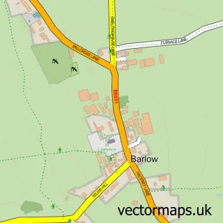
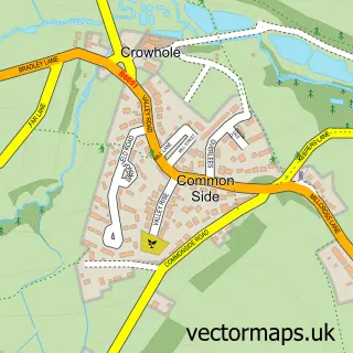
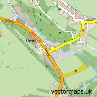
This Cutthorpe street map is a detailed vector street map covering a 750m x 750m area. Select a larger area to create and download your own vector street map of Cutthorpe.
The 750-metre map sample for Cutthorpe covers 101 mapped buildings and approximately 6.8 km of road detail, of which 6 named roads are named. The immediate area includes 2 GP surgeries within 2 miles, 2 pubs and 8 MOT stations within 2 miles. The wider area around Cutthorpe features 2 food and drink venues. To create a larger or custom map of Cutthorpe, the map builder lets you define your own coverage area and download editable SVG, PDF and PNG files.
Create a larger editable map of Cutthorpe
Choose any area you need and generate a high-quality vector map instantly. Perfect for print, planning, design, business and personal use.

This Cutthorpe street map in Derbyshire is available as downloadable SVG, PDF and PNG map files, or as a printed map for planning, business, display, education, local information and design work. You can also create a larger custom map area using the map selector.
What this Cutthorpe map sample shows
Cutthorpe lies within Brampton Cp parish, part of Brampton & Walton ward in the North East Derbyshire District local authority area. The postcode geography for this area includes the S postcode area, the S42 postcode district and the S42 7 postcode sector. Residents fall under the Nhs Derby And Derbyshire Integrated Care Board for NHS services.
Local features near Cutthorpe
Within 2 milesAmenities and services in and around Cutthorpe.
Administrative and postcode information for Cutthorpe
Cutthorpe lies within Brampton Cp parish, part of Brampton & Walton ward in the North East Derbyshire District local authority area. The postcode geography for this area includes the S postcode area, the S42 postcode district and the S42 7 postcode sector. Residents fall under the Nhs Derby And Derbyshire Integrated Care Board for NHS services.
Nearby street map samples around Cutthorpe

More street maps in Derbyshire
750 metre map area coverage
Boundary, postcode and point of interest information for the 750m x 750m rectangle centred on this sample map.
Boundaries containing map centre
Constituency: North East Derbyshire Co Const
County: Derbyshire County
District: North East Derbyshire District
Icb: NHS Derby and Derbyshire ICB
Parish: Brampton CP
Police Force: derbyshire
Postcode District: S42
Postcode Sector: S42 7
Ward: Brampton & Walton Ward
Nearby boundaries intersecting sample
Postcode District: S41
Postcode Sector: S41 9
Postcode coverage
POI category counts
Pub: 2
Building Supply Store: 1
Cleaning Services: 1
Community Center: 1
Contractor: 1
Cricket Ground: 1
Holiday Rental Home: 1
Structure And Geography: 1
Sample points of interest
- IMF Kitchens Ltd
- Moody Moo
- Cutthorpe Institute
- Lane Builders
- Cutthorpe Cricket Club
- Wood view lodge
- The Three Merry Lads
- Three Merry Lads - Cutthorpe 2024
- Cutthorpe Chesterfield
Create a larger editable map of Cutthorpe
This sample shows only a 750 metre area. To create a larger map of Cutthorpe, use our map builder to choose your own coverage area, add titles and download editable SVG, PDF and PNG files.
Create a custom map of Cutthorpe