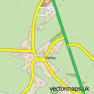
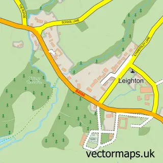
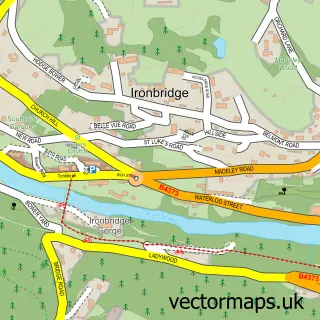
This Homer street map is a detailed vector street map covering a 750m x 750m area. Select a larger area to create and download your own vector street map of Homer.
The 750-metre map sample for Homer covers 148 mapped buildings and approximately 7.5 km of road detail, of which 4 named roads are named. The immediate area includes 1 GP surgery within 2 miles. The wider area around Homer features 1 tourism point of interest and 1 campsite within 2 miles. To create a larger or custom map of Homer, the map builder lets you define your own coverage area and download editable SVG, PDF and PNG files.
Create a larger editable map of Homer
Choose any area you need and generate a high-quality vector map instantly. Perfect for print, planning, design, business and personal use.

This Homer street map in Shropshire is available as downloadable SVG, PDF and PNG map files, or as a printed map for planning, business, display, education, local information and design work. You can also create a larger custom map area using the map selector.
What this Homer map sample shows
Homer lies within Much Wenlock Cp parish, part of Much Wenlock ward in the Shropshire local authority area. The postcode geography for this area includes the TF postcode area, the TF13 postcode district and the TF13 6 postcode sector. Residents fall under the Nhs Shropshire, Telford And Wrekin Integrated Care Board for NHS services.
Local features near Homer
Within 2 milesAmenities and services in and around Homer.
Administrative and postcode information for Homer
Homer lies within Much Wenlock Cp parish, part of Much Wenlock ward in the Shropshire local authority area. The postcode geography for this area includes the TF postcode area, the TF13 postcode district and the TF13 6 postcode sector. Residents fall under the Nhs Shropshire, Telford And Wrekin Integrated Care Board for NHS services.
Nearby street map samples around Homer

More street maps in Shropshire
750 metre map area coverage
Boundary, postcode and point of interest information for the 750m x 750m rectangle centred on this sample map.
Boundaries containing map centre
Constituency: South Shropshire Co Const
District: Shropshire
Icb: NHS Shropshire Telford and Wrekin ICB
Parish: Much Wenlock CP
Police Force: west mercia
Postcode District: TF13
Postcode Sector: TF13 6
Nearby boundaries intersecting sample
Parish: Sheinton CP
Postcode coverage
POI category counts
Beauty Salon: 1
Bed And Breakfast: 1
Hardware Store: 1
Landmark And Historical Building: 1
Printing Services: 1
Truck Dealer: 1
Sample points of interest
- Coalport Skin Clinic
- Coppice View B&B
- Caravan Canopy Shop
- Homer, Shropshire
- Marsh Mill Promotions
- Midland Precision Blasting
Create a larger editable map of Homer
This sample shows only a 750 metre area. To create a larger map of Homer, use our map builder to choose your own coverage area, add titles and download editable SVG, PDF and PNG files.
Create a custom map of Homer