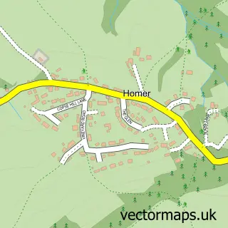
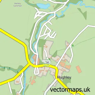
This Harley street map is a detailed vector street map covering a 750m x 750m area. Select a larger area to create and download your own vector street map of Harley.
The 750-metre map sample for Harley covers 106 mapped buildings and approximately 10.2 km of road detail. The immediate area includes 1 GP surgery within 2 miles. The wider area around Harley features 1 campsite within 2 miles. To create a larger or custom map of Harley, the map builder lets you define your own coverage area and download editable SVG, PDF and PNG files.
Create a larger editable map of Harley
Choose any area you need and generate a high-quality vector map instantly. Perfect for print, planning, design, business and personal use.

This Harley street map in Shropshire is available as downloadable SVG, PDF and PNG map files, or as a printed map for planning, business, display, education, local information and design work. You can also create a larger custom map area using the map selector.
What this Harley map sample shows
Harley lies within Harley Cp parish, part of Severn Valley ward in the Shropshire local authority area. The postcode geography for this area includes the SY postcode area, the SY5 postcode district and the SY5 6 postcode sector. Residents fall under the Nhs Shropshire, Telford And Wrekin Integrated Care Board for NHS services.
Local features near Harley
Within 2 milesAmenities and services in and around Harley.
Administrative and postcode information for Harley
Harley lies within Harley Cp parish, part of Severn Valley ward in the Shropshire local authority area. The postcode geography for this area includes the SY postcode area, the SY5 postcode district and the SY5 6 postcode sector. Residents fall under the Nhs Shropshire, Telford And Wrekin Integrated Care Board for NHS services.
Nearby street map samples around Harley


More street maps in Shropshire
750 metre map area coverage
Boundary, postcode and point of interest information for the 750m x 750m rectangle centred on this sample map.
Boundaries containing map centre
Constituency: South Shropshire Co Const
District: Shropshire
Icb: NHS Shropshire Telford and Wrekin ICB
Parish: Harley CP
Police Force: west mercia
Postcode District: SY5
Postcode Sector: SY5 6
Nearby boundaries intersecting sample
No additional intersecting boundaries found.
Postcode coverage
POI category counts
Advertising Agency: 1
Anglican Church: 1
Bar: 1
Business: 1
Community Center: 1
Electrician: 1
Graphic Designer: 1
Holiday Rental Home: 1
Livestock Feed And Supply Store: 1
Professional Services: 1
Sample points of interest
- Peachtree UK
- Harley: St Mary
- The Harley Raceway
- Blue Chip Coaching
- Harley Village Hall
- DLM Electrical Contractors
- Peachtree
- Swallows Holiday Cottage Much Wenlock, Shropshire
- Cambers Country Stores Ltd.
- Dlm Electrical Contractors Limited
Create a larger editable map of Harley
This sample shows only a 750 metre area. To create a larger map of Harley, use our map builder to choose your own coverage area, add titles and download editable SVG, PDF and PNG files.
Create a custom map of Harley