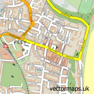
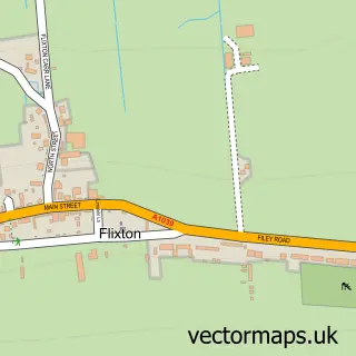
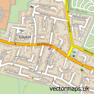
This Hunmanby street map is a detailed vector street map covering a 750m x 750m area. Select a larger area to create and download your own vector street map of Hunmanby.
The 750-metre map sample for Hunmanby covers 437 mapped buildings and approximately 14.8 km of road detail, of which 28 named roads are named. The immediate area includes 1 school, 1 GP surgery, 3 pubs and 1 MOT station, with 2 within 2 miles. The wider area around Hunmanby features 2 tourism points of interest, 7 food and drink venues and 1 hotel. To create a larger or custom map of Hunmanby, the map builder lets you define your own coverage area and download editable SVG, PDF and PNG files.
Create a larger editable map of Hunmanby
Choose any area you need and generate a high-quality vector map instantly. Perfect for print, planning, design, business and personal use.

This Hunmanby street map in North Yorkshire is available as downloadable SVG, PDF and PNG map files, or as a printed map for planning, business, display, education, local information and design work. You can also create a larger custom map area using the map selector.
What this Hunmanby map sample shows
Hunmanby lies within Hunmanby Cp parish, part of Hunmanby ward in the North Yorkshire local authority area. The postcode geography for this area includes the YO postcode area, the YO14 postcode district and the YO14 0 postcode sector. Residents fall under the Nhs Humber And North Yorkshire Integrated Care Board for NHS services.
Local features near Hunmanby
Within 2 milesAmenities and services in and around Hunmanby.
Administrative and postcode information for Hunmanby
Hunmanby lies within Hunmanby Cp parish, part of Hunmanby ward in the North Yorkshire local authority area. The postcode geography for this area includes the YO postcode area, the YO14 postcode district and the YO14 0 postcode sector. Residents fall under the Nhs Humber And North Yorkshire Integrated Care Board for NHS services.
Nearby street map samples around Hunmanby

More street maps in North Yorkshire
750 metre map area coverage
Boundary, postcode and point of interest information for the 750m x 750m rectangle centred on this sample map.
Boundaries containing map centre
Constituency: Thirsk and Malton Co Const
District: North Yorkshire
Icb: NHS Humber and North Yorkshire ICB
Parish: Hunmanby CP
Police Force: north yorkshire
Postcode District: YO14
Postcode Sector: YO14 0
Nearby boundaries intersecting sample
No additional intersecting boundaries found.
Postcode coverage
POI category counts
Beauty Salon: 4
Convenience Store: 3
Pub: 3
Cafe: 2
Church Cathedral: 2
Cottage: 2
Fish And Chips Restaurant: 2
Post Office: 2
Asian Restaurant: 1
Atms: 1
Sample points of interest
- Spinners Take Away Food Shops
- The Cooperative Food (BF) Hunmanby, Hunmanby
- Stonegate Garage
- Warren James barber shop
- Beauty And The Barber
- Dreams Hair & Beauty Salon
- Michelle at Blush Nails & Beauty
- Sarah's Beauty
- The Southgate B&B Hunmanby
- Sue’s Bar
- Wells Butchers
- Spring Cafe
Create a larger editable map of Hunmanby
This sample shows only a 750 metre area. To create a larger map of Hunmanby, use our map builder to choose your own coverage area, add titles and download editable SVG, PDF and PNG files.
Create a custom map of Hunmanby