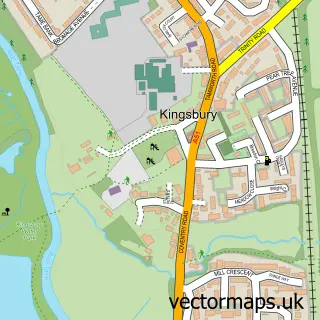
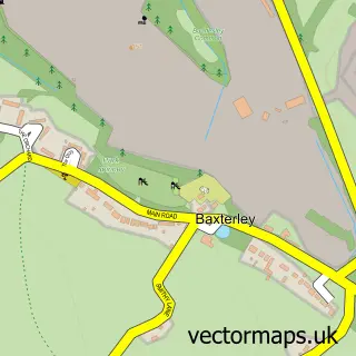
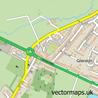
This Hurley street map is a detailed vector street map covering a 750m x 750m area. Select a larger area to create and download your own vector street map of Hurley.
The 750-metre map sample for Hurley covers 216 mapped buildings and approximately 20.6 km of road detail, of which 24 named roads are named. The immediate area includes 1 school, 1 GP surgery within 2 miles, 2 pubs and 3 MOT stations within 2 miles. The wider area around Hurley features 3 food and drink venues. To create a larger or custom map of Hurley, the map builder lets you define your own coverage area and download editable SVG, PDF and PNG files.
Create a larger editable map of Hurley
Choose any area you need and generate a high-quality vector map instantly. Perfect for print, planning, design, business and personal use.

This Hurley street map in Warwickshire is available as downloadable SVG, PDF and PNG map files, or as a printed map for planning, business, display, education, local information and design work. You can also create a larger custom map area using the map selector.
What this Hurley map sample shows
Hurley lies within Kingsbury Cp parish, part of Hurley And Wood End ward in the North Warwickshire District (B) local authority area. The postcode geography for this area includes the CV postcode area, the CV9 postcode district and the CV9 2 postcode sector. Residents fall under the Nhs Coventry And Warwickshire Integrated Care Board for NHS services.
Local features near Hurley
Within 2 milesAmenities and services in and around Hurley.
Administrative and postcode information for Hurley
Hurley lies within Kingsbury Cp parish, part of Hurley And Wood End ward in the North Warwickshire District (B) local authority area. The postcode geography for this area includes the CV postcode area, the CV9 postcode district and the CV9 2 postcode sector. Residents fall under the Nhs Coventry And Warwickshire Integrated Care Board for NHS services.
Nearby street map samples around Hurley

More street maps in Warwickshire
750 metre map area coverage
Boundary, postcode and point of interest information for the 750m x 750m rectangle centred on this sample map.
Boundaries containing map centre
Constituency: North Warwickshire and Bedworth Co Const
County: Warwickshire County
District: North Warwickshire District (B)
Icb: NHS Coventry and Warwickshire ICB
Parish: Kingsbury CP
Police Force: warwickshire
Postcode District: CV9
Postcode Sector: CV9 2
Ward: Hurley and Wood End Ward
Nearby boundaries intersecting sample
No additional intersecting boundaries found.
Postcode coverage
POI category counts
Convenience Store: 3
Bar: 2
Elementary School: 2
Pub: 2
Advertising Agency: 1
Anglican Church: 1
Carpet Store: 1
Church Cathedral: 1
Doctor: 1
Gym: 1
Sample points of interest
- KTA Design
- The Resurrection
- The Black Sheep
- The Holly Bush
- Midland Flooring Services
- Church of the Resurrection
- Hurley Village Shop
- Premier
- Premier Hurley Convenience Store
- Pear Tree Surgery (Hurley Branch)
- Hurley Primary School
- Hurley Primary School
Create a larger editable map of Hurley
This sample shows only a 750 metre area. To create a larger map of Hurley, use our map builder to choose your own coverage area, add titles and download editable SVG, PDF and PNG files.
Create a custom map of Hurley