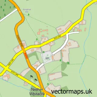
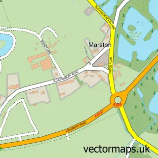
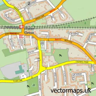
This Whitacre Heath street map is a detailed vector street map covering a 750m x 750m area. Select a larger area to create and download your own vector street map of Whitacre Heath.
The 750-metre map sample for Whitacre Heath covers 135 mapped buildings and approximately 11.0 km of road detail, of which 6 named roads are named. The immediate area includes 3 pubs and 2 MOT stations within 2 miles. The wider area around Whitacre Heath features 3 food and drink venues. To create a larger or custom map of Whitacre Heath, the map builder lets you define your own coverage area and download editable SVG, PDF and PNG files.
Create a larger editable map of Whitacre Heath
Choose any area you need and generate a high-quality vector map instantly. Perfect for print, planning, design, business and personal use.

This Whitacre Heath street map in Warwickshire is available as downloadable SVG, PDF and PNG map files, or as a printed map for planning, business, display, education, local information and design work. You can also create a larger custom map area using the map selector.
What this Whitacre Heath map sample shows
Whitacre Heath lies within Nether Whitacre Cp parish, part of Curdworth ward in the North Warwickshire District (B) local authority area. The postcode geography for this area includes the B postcode area, the B46 postcode district and the B46 2 postcode sector. Residents fall under the Nhs Coventry And Warwickshire Integrated Care Board for NHS services.
Local features near Whitacre Heath
Within 2 milesAmenities and services in and around Whitacre Heath.
Administrative and postcode information for Whitacre Heath
Whitacre Heath lies within Nether Whitacre Cp parish, part of Curdworth ward in the North Warwickshire District (B) local authority area. The postcode geography for this area includes the B postcode area, the B46 postcode district and the B46 2 postcode sector. Residents fall under the Nhs Coventry And Warwickshire Integrated Care Board for NHS services.
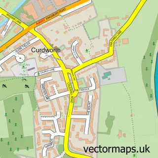
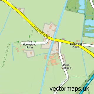
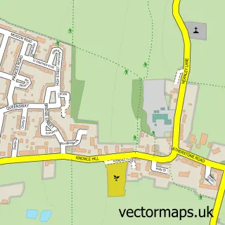
Nearby street map samples around Whitacre Heath

More street maps in Warwickshire
750 metre map area coverage
Boundary, postcode and point of interest information for the 750m x 750m rectangle centred on this sample map.
Boundaries containing map centre
Constituency: North Warwickshire and Bedworth Co Const
County: Warwickshire County
District: North Warwickshire District (B)
Icb: NHS Coventry and Warwickshire ICB
Parish: Nether Whitacre CP
Police Force: warwickshire
Postcode District: B46
Postcode Sector: B46 2
Ward: Curdworth Ward
Nearby boundaries intersecting sample
No additional intersecting boundaries found.
Postcode coverage
POI category counts
Land Surveying: 3
Pub: 3
Post Office: 2
Truck Dealer For Businesses: 2
Auto Electrical Repair: 1
Automation Services: 1
Bed And Breakfast: 1
Community Center: 1
Counseling And Mental Health: 1
Cricket Ground: 1
Sample points of interest
- Blythe Electrical
- IRob International
- Langley Cottage Guest House
- Nether Whitacre Village Hall
- Confidential Counselling
- Nether Whitacre Cricket Club
- KJS Training Ltd
- Green & Country
- BPI Coleshill
- G3 Quantity Surveying
- MBPC Infrastructure
- Mbpc Infrastructure Ltd.
Create a larger editable map of Whitacre Heath
This sample shows only a 750 metre area. To create a larger map of Whitacre Heath, use our map builder to choose your own coverage area, add titles and download editable SVG, PDF and PNG files.
Create a custom map of Whitacre Heath