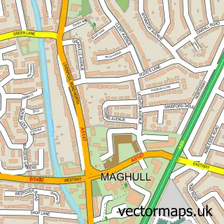
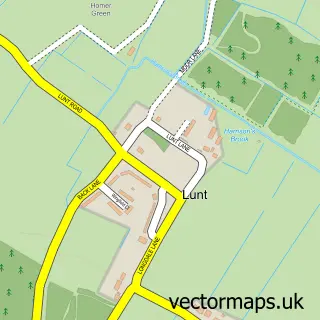
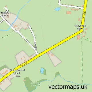
This Kennessee Green street map is a detailed vector street map covering a 750m x 750m area. Select a larger area to create and download your own vector street map of Kennessee Green.
The 750-metre map sample for Kennessee Green covers 458 mapped buildings and approximately 22.5 km of road detail, of which 37 named roads are named. The immediate area includes 2 schools, 5 GP surgeries within 2 miles, 3 pubs and 12 MOT stations within 2 miles. The wider area around Kennessee Green features 2 tourism points of interest and 11 food and drink venues. To create a larger or custom map of Kennessee Green, the map builder lets you define your own coverage area and download editable SVG, PDF and PNG files.
Create a larger editable map of Kennessee Green
Choose any area you need and generate a high-quality vector map instantly. Perfect for print, planning, design, business and personal use.

This Kennessee Green street map in Merseyside is available as downloadable SVG, PDF and PNG map files, or as a printed map for planning, business, display, education, local information and design work. You can also create a larger custom map area using the map selector.
What this Kennessee Green map sample shows
Kennessee Green lies within Maghull Cp parish, part of Park ward in the Sefton District (B) local authority area. The postcode geography for this area includes the L postcode area, the L31 postcode district and the L31 0 postcode sector. Residents fall under the Nhs Cheshire And Merseyside Integrated Care Board for NHS services.
Local features near Kennessee Green
Within 2 milesAmenities and services in and around Kennessee Green.
Administrative and postcode information for Kennessee Green
Kennessee Green lies within Maghull Cp parish, part of Park ward in the Sefton District (B) local authority area. The postcode geography for this area includes the L postcode area, the L31 postcode district and the L31 0 postcode sector. Residents fall under the Nhs Cheshire And Merseyside Integrated Care Board for NHS services.
Nearby street map samples around Kennessee Green

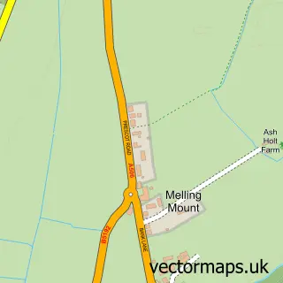
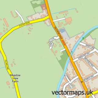
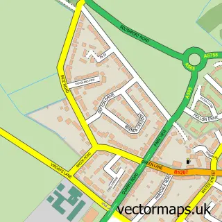
More street maps in Merseyside
750 metre map area coverage
Boundary, postcode and point of interest information for the 750m x 750m rectangle centred on this sample map.
Boundaries containing map centre
Constituency: Sefton Central Co Const
District: Sefton District (B)
Icb: NHS Lancashire and South Cumbria ICB
Parish: Maghull CP
Police Force: merseyside
Postcode District: L31
Postcode Sector: L31 5
Ward: Sudell Ward
Nearby boundaries intersecting sample
Parish: Sefton CP
Postcode District: L29
Postcode Sector: L29 9, L31 3, L31 7
Ward: Molyneux Ward, Park Ward
Postcode coverage
POI category counts
Beauty Salon: 11
Coffee Shop: 6
Gym: 4
Hair Salon: 4
Chinese Restaurant: 3
Park: 3
Professional Services: 3
Pub: 3
Supermarket: 3
Betting Center: 2
Sample points of interest
- Liverpool Maghull
- Life Saving Club
- St John Ambulance South Sefton
- C & S Domestic Appliance Repairs
- TK Entertainments
- Costcutter (CZI)
- P and G Motor Accessories
- Maghull Baptist Church
- Son of a Barber
- Adara Wellness and Beauty
- Bare Radiance
- Gemma Louise Hair Make-up & Beauty Salon
Create a larger editable map of Kennessee Green
This sample shows only a 750 metre area. To create a larger map of Kennessee Green, use our map builder to choose your own coverage area, add titles and download editable SVG, PDF and PNG files.
Create a custom map of Kennessee Green