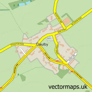
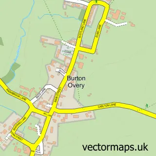
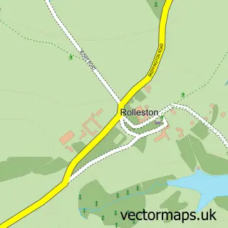
This King's Norton street map is a detailed vector street map covering a 750m x 750m area. Select a larger area to create and download your own vector street map of King's Norton.
The 750-metre map sample for King's Norton covers 44 mapped buildings and approximately 18.1 km of road detail, of which 5 named roads are named. The immediate area includes 1 MOT station within 2 miles. To create a larger or custom map of King's Norton, the map builder lets you define your own coverage area and download editable SVG, PDF and PNG files.
Create a larger editable map of King's Norton
Choose any area you need and generate a high-quality vector map instantly. Perfect for print, planning, design, business and personal use.

This King's Norton street map in Leicestershire is available as downloadable SVG, PDF and PNG map files, or as a printed map for planning, business, display, education, local information and design work. You can also create a larger custom map area using the map selector.
What this King's Norton map sample shows
King's Norton lies within King's Norton Cp parish, part of Glen ward in the Harborough District local authority area. The postcode geography for this area includes the LE postcode area, the LE7 postcode district and the LE7 9 postcode sector. Residents fall under the Nhs Leicester, Leicestershire And Rutland Integrated Care Board for NHS services.
Local features near King's Norton
Within 2 milesAmenities and services in and around King's Norton.
Administrative and postcode information for King's Norton
The local authority covering King's Norton is Harborough District, within the county of Leicestershire. The settlement lies within Glen ward and King's Norton Cp civil parish. The LE7 postcode district and LE7 9 postcode sector serve the immediate area. NHS provision in the area is delivered through University Hospitals Of Leicester Nhs Trust.
Nearby street map samples around King's Norton

More street maps in Leicestershire
750 metre map area coverage
Boundary, postcode and point of interest information for the 750m x 750m rectangle centred on this sample map.
Boundaries containing map centre
Constituency: Harborough, Oadby and Wigston Co Const
County: Leicestershire County
District: Harborough District
Icb: NHS Leicester Leicestershire and Rutland ICB
Parish: King's Norton CP
Police Force: leicestershire
Postcode District: LE7
Postcode Sector: LE7 9
Ward: Glen Ward
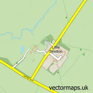
Nearby boundaries intersecting sample
Parish: Gaulby CP
Postcode coverage
POI category counts
Health And Medical: 2
Anglican Church: 1
Corporate Office: 1
Home Goods Store: 1
Sample points of interest
- Kings Norton: St John the Baptist
- Visible Pages
- Sunflower Retreats Holidays
- The Retreat Company
- Pottertonpacs Ltd.
Create a larger editable map of King's Norton
This sample shows only a 750 metre area. To create a larger map of King's Norton, use our map builder to choose your own coverage area, add titles and download editable SVG, PDF and PNG files.
Create a custom map of King's Norton