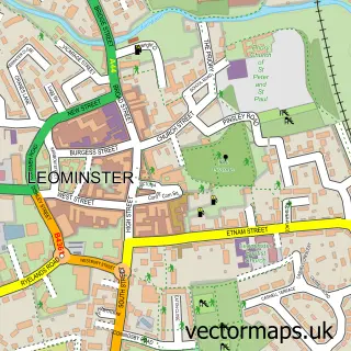
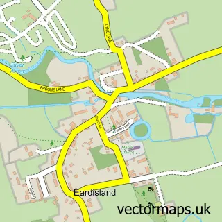
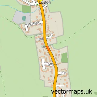
This Kingsland street map is a detailed vector street map covering a 750m x 750m area. Select a larger area to create and download your own vector street map of Kingsland.
The 750-metre map sample for Kingsland covers 180 mapped buildings and approximately 18.5 km of road detail, of which 11 named roads are named. The immediate area includes 1 school, 1 GP surgery, 2 pubs and 1 MOT station. The wider area around Kingsland features 2 tourism points of interest, 3 food and drink venues and 1 campsite within 2 miles. To create a larger or custom map of Kingsland, the map builder lets you define your own coverage area and download editable SVG, PDF and PNG files.
Create a larger editable map of Kingsland
Choose any area you need and generate a high-quality vector map instantly. Perfect for print, planning, design, business and personal use.

This Kingsland street map in Herefordshire is available as downloadable SVG, PDF and PNG map files, or as a printed map for planning, business, display, education, local information and design work. You can also create a larger custom map area using the map selector.
What this Kingsland map sample shows
Kingsland lies within Kingsland Cp parish, part of Bircher ward in the County Of Herefordshire local authority area. The postcode geography for this area includes the HR postcode area, the HR6 postcode district and the HR6 9 postcode sector. Residents fall under the Nhs Herefordshire And Worcestershire Integrated Care Board for NHS services.
Local features near Kingsland
Within 2 milesAmenities and services in and around Kingsland.
Administrative and postcode information for Kingsland
The local authority covering Kingsland is County Of Herefordshire, within the county of Herefordshire. The settlement lies within Bircher ward and Kingsland Cp civil parish. The HR6 postcode district and HR6 9 postcode sector serve the immediate area. NHS provision in the area is delivered through Wye Valley Nhs Trust.
Nearby street map samples around Kingsland

More street maps in Herefordshire
750 metre map area coverage
Boundary, postcode and point of interest information for the 750m x 750m rectangle centred on this sample map.
Boundaries containing map centre
Constituency: North Herefordshire Co Const
District: County of Herefordshire
Icb: NHS Herefordshire and Worcestershire ICB
Parish: Kingsland CP
Police Force: west mercia
Postcode District: HR6
Postcode Sector: HR6 9
Ward: Bircher Ward
Nearby boundaries intersecting sample
No additional intersecting boundaries found.
Postcode coverage
POI category counts
Anglican Church: 2
Building Supply Store: 2
Doctor: 2
Photography Store And Services: 2
Pub: 2
Arts And Entertainment: 1
Automotive Repair: 1
Bed And Breakfast: 1
Cafe: 1
Campground: 1
Sample points of interest
- Kingsland St Michael's and All Angels Church
- Kingsland: St Michael & All Angels
- Kingsland Coronation Hall
- Markhams Garage Ltd
- Corners Inn
- Gary Pearson Roofing Ltd
- S M Juson
- The Garden Tea Room & Deli
- Glamping at The Arbour Kingsland
- Infinity Dance and Performing Arts
- Mortimer Medical Practice
- The Mortimer Medical Prac
Create a larger editable map of Kingsland
This sample shows only a 750 metre area. To create a larger map of Kingsland, use our map builder to choose your own coverage area, add titles and download editable SVG, PDF and PNG files.
Create a custom map of Kingsland