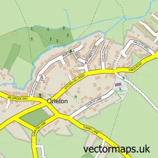
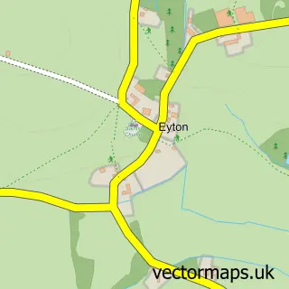
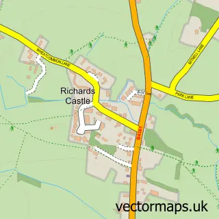
This Yarpole street map is a detailed vector street map covering a 750m x 750m area. Select a larger area to create and download your own vector street map of Yarpole.
The 750-metre map sample for Yarpole covers 199 mapped buildings and approximately 19.0 km of road detail, of which 6 named roads are named. The immediate area includes 1 pub. The wider area around Yarpole features 2 food and drink venues. To create a larger or custom map of Yarpole, the map builder lets you define your own coverage area and download editable SVG, PDF and PNG files.
Create a larger editable map of Yarpole
Choose any area you need and generate a high-quality vector map instantly. Perfect for print, planning, design, business and personal use.

This Yarpole street map in Herefordshire is available as downloadable SVG, PDF and PNG map files, or as a printed map for planning, business, display, education, local information and design work. You can also create a larger custom map area using the map selector.
What this Yarpole map sample shows
Yarpole lies within Croft And Yarpole Cp parish, part of Bircher ward in the County Of Herefordshire local authority area. The postcode geography for this area includes the HR postcode area, the HR6 postcode district and the HR6 0 postcode sector. Residents fall under the Nhs Herefordshire And Worcestershire Integrated Care Board for NHS services.
Local features near Yarpole
Within 2 milesAmenities and services in and around Yarpole.
Administrative and postcode information for Yarpole
Yarpole lies within Croft And Yarpole Cp parish, part of Bircher ward in the County Of Herefordshire local authority area. The postcode geography for this area includes the HR postcode area, the HR6 postcode district and the HR6 0 postcode sector. Residents fall under the Nhs Herefordshire And Worcestershire Integrated Care Board for NHS services.
Nearby street map samples around Yarpole

More street maps in Herefordshire
750 metre map area coverage
Boundary, postcode and point of interest information for the 750m x 750m rectangle centred on this sample map.
Boundaries containing map centre
Constituency: North Herefordshire Co Const
District: County of Herefordshire
Icb: NHS Herefordshire and Worcestershire ICB
Parish: Croft and Yarpole CP
Police Force: west mercia
Postcode District: HR6
Postcode Sector: HR6 0
Ward: Bircher Ward
Nearby boundaries intersecting sample
Postcode Sector: HR6 9
Postcode coverage
POI category counts
Anglican Church: 2
Convenience Store: 2
Post Office: 2
Bookstore: 1
British Restaurant: 1
Cabin: 1
Cafe: 1
Educational Services: 1
Pet Groomer: 1
Professional Services: 1
Sample points of interest
- St Leonard's Church
- St. Leonard's Yarpole
- Rosie's Book Store
- The Bell Inn
- Shire Escapes - Shepherd Huts, Hot Tubs, Firepits
- Gallery cafe
- Yarpole Community Shop
- Yarpole Village Shop Within St Leonards Church
- Warrior Monk
- Rosie's Grooming Room - Yarpole, Leominster & Ludlow
- Post Office
- Yarpole Post Office
Create a larger editable map of Yarpole
This sample shows only a 750 metre area. To create a larger map of Yarpole, use our map builder to choose your own coverage area, add titles and download editable SVG, PDF and PNG files.
Create a custom map of Yarpole