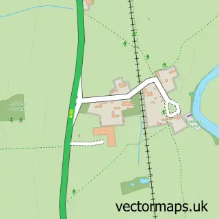
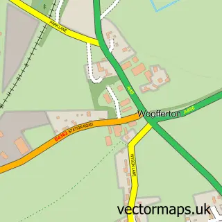
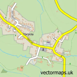
This Richard's Castle street map is a detailed vector street map covering a 750m x 750m area. Select a larger area to create and download your own vector street map of Richard's Castle.
The 750-metre map sample for Richard's Castle covers 96 mapped buildings and approximately 27.8 km of road detail, of which 4 named roads are named. The wider area around Richard's Castle features 1 food and drink venue. To create a larger or custom map of Richard's Castle, the map builder lets you define your own coverage area and download editable SVG, PDF and PNG files.
Create a larger editable map of Richard's Castle
Choose any area you need and generate a high-quality vector map instantly. Perfect for print, planning, design, business and personal use.

This Richard's Castle street map in Herefordshire is available as downloadable SVG, PDF and PNG map files, or as a printed map for planning, business, display, education, local information and design work. You can also create a larger custom map area using the map selector.
What this Richard's Castle map sample shows
Richard's Castle lies within Richards Castle (Hereford) Cp parish, part of Bircher ward in the County Of Herefordshire local authority area. The postcode geography for this area includes the SY postcode area, the SY8 postcode district and the SY8 4 postcode sector. Residents fall under the Nhs Herefordshire And Worcestershire Integrated Care Board for NHS services.
Local features near Richard's Castle
Within 2 milesAmenities and services in and around Richard's Castle.
Administrative and postcode information for Richard's Castle
The local authority covering Richard's Castle is County Of Herefordshire, within the county of Herefordshire. The settlement lies within Bircher ward and Richards Castle (Hereford) Cp civil parish. The SY8 postcode district and SY8 4 postcode sector serve the immediate area. NHS provision in the area is delivered through Worcestershire Acute Hospitals Nhs Trust.
Nearby street map samples around Richard's Castle

More street maps in Herefordshire
750 metre map area coverage
Boundary, postcode and point of interest information for the 750m x 750m rectangle centred on this sample map.
Boundaries containing map centre
Constituency: North Herefordshire Co Const
District: County of Herefordshire
Icb: NHS Herefordshire and Worcestershire ICB
Parish: Richards Castle (Hereford) CP
Police Force: west mercia
Postcode District: SY8
Postcode Sector: SY8 4
Ward: Bircher Ward
Nearby boundaries intersecting sample
Constituency: South Shropshire Co Const
District: Shropshire
Icb: NHS Shropshire Telford and Wrekin ICB
Parish: Richard's Castle (Shropshire) CP
Postcode coverage
POI category counts
Beauty Salon: 2
Agriculture: 1
Alternative Medicine: 1
Bar: 1
Community Center: 1
Driving School: 1
Gardener: 1
Landscaping: 1
Restaurant: 1
Sample points of interest
- G & R Tudge
- Colonic Hydrotherapy Clinic West Midlands
- Castle Inn
- Beauty With A View
- Erica Sian Beauty Studio
- Richards Castle Village Hall
- Todson Driving
- Unique Landscapes
- Unique Landscapes
- The Castle Inn
Create a larger editable map of Richard's Castle
This sample shows only a 750 metre area. To create a larger map of Richard's Castle, use our map builder to choose your own coverage area, add titles and download editable SVG, PDF and PNG files.
Create a custom map of Richard's Castle