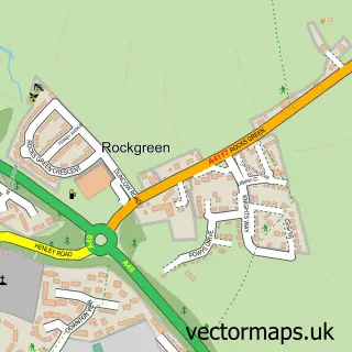
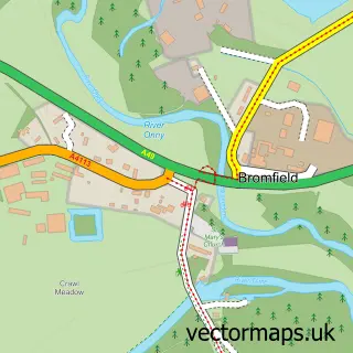
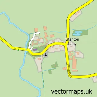
This Ludlow street map is a detailed vector street map covering a 750m x 750m area. Select a larger area to create and download your own vector street map of Ludlow.
The 750-metre map sample for Ludlow covers 315 mapped buildings and approximately 47.2 km of road detail, of which 38 named roads are named. The immediate area includes 1 school, 1 railway station, 2 GP surgeries and 12 pubs among other local services. The wider area around Ludlow features 9 tourism points of interest, 44 food and drink venues and 12 hotels. To create a larger or custom map of Ludlow, the map builder lets you define your own coverage area and download editable SVG, PDF and PNG files.
Create a larger editable map of Ludlow
Choose any area you need and generate a high-quality vector map instantly. Perfect for print, planning, design, business and personal use.

This Ludlow street map in Shropshire is available as downloadable SVG, PDF and PNG map files, or as a printed map for planning, business, display, education, local information and design work. You can also create a larger custom map area using the map selector.
What this Ludlow map sample shows
Ludlow lies within Ludlow Cp parish, part of Ludlow North ward in the Shropshire local authority area. The postcode geography for this area includes the SY postcode area, the SY8 postcode district and the SY8 1 postcode sector. Residents fall under the Nhs Shropshire, Telford And Wrekin Integrated Care Board for NHS services.
Local features near Ludlow
Within 2 milesAmenities and services in and around Ludlow.
Administrative and postcode information for Ludlow
Ludlow lies within Ludlow Cp parish, part of Ludlow North ward in the Shropshire local authority area. The postcode geography for this area includes the SY postcode area, the SY8 postcode district and the SY8 1 postcode sector. Residents fall under the Nhs Shropshire, Telford And Wrekin Integrated Care Board for NHS services.
Nearby street map samples around Ludlow

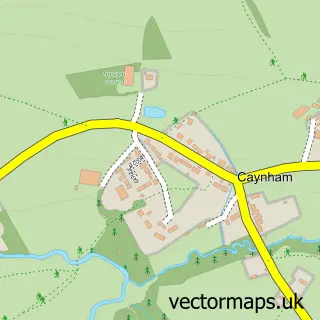
More street maps in Shropshire
750 metre map area coverage
Boundary, postcode and point of interest information for the 750m x 750m rectangle centred on this sample map.
Boundaries containing map centre
Constituency: South Shropshire Co Const
District: Shropshire
Icb: NHS Shropshire Telford and Wrekin ICB
Parish: Ludlow CP
Police Force: west mercia
Postcode District: SY8
Postcode Sector: SY8 1
Nearby boundaries intersecting sample
Postcode Sector: SY8 2
Postcode coverage
POI category counts
Clothing Store: 18
Restaurant: 14
Hotel: 12
Pub: 12
Art Gallery: 10
Flowers And Gifts Shop: 10
Hair Salon: 10
Real Estate Agent: 10
Cafe: 9
Coffee Shop: 9
Sample points of interest
- TaxAssist Accountants
- Pendleton Associates
- Think Graphic Design
- McCartneys Rural
- Morris, Bufton & Co. Ltd.
- Earl of Plymouth Estates
- St Laurence's Church
- St Laurence's Parish Church, Ludlow
- Pricklebums Hedgehog Rescue
- Continuity Fairs
- D W & a B Bayliss
- Dawn Jones at Upper Track Antiques
Create a larger editable map of Ludlow
This sample shows only a 750 metre area. To create a larger map of Ludlow, use our map builder to choose your own coverage area, add titles and download editable SVG, PDF and PNG files.
Create a custom map of Ludlow