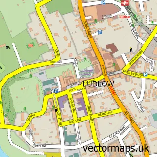
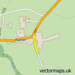
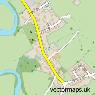
This Rocks Green street map is a detailed vector street map covering a 750m x 750m area. Select a larger area to create and download your own vector street map of Rocks Green.
The 750-metre map sample for Rocks Green covers 198 mapped buildings and approximately 30.0 km of road detail, of which 8 named roads are named. The immediate area includes 2 GP surgeries within 2 miles, 1 pub and 7 MOT stations within 2 miles. The wider area around Rocks Green features 1 tourism point of interest, 2 food and drink venues and 1 hotel. To create a larger or custom map of Rocks Green, the map builder lets you define your own coverage area and download editable SVG, PDF and PNG files.
Create a larger editable map of Rocks Green
Choose any area you need and generate a high-quality vector map instantly. Perfect for print, planning, design, business and personal use.

This Rocks Green street map in Shropshire is available as downloadable SVG, PDF and PNG map files, or as a printed map for planning, business, display, education, local information and design work. You can also create a larger custom map area using the map selector.
What this Rocks Green map sample shows
Rocks Green lies within Ludlow Cp parish, part of Ludlow North ward in the Shropshire local authority area. The postcode geography for this area includes the SY postcode area, the SY8 postcode district and the SY8 1 postcode sector. Residents fall under the Nhs Shropshire, Telford And Wrekin Integrated Care Board for NHS services.
Local features near Rocks Green
Within 2 milesAmenities and services in and around Rocks Green.
Administrative and postcode information for Rocks Green
The local authority covering Rocks Green is Shropshire, within the county of Shropshire. The settlement lies within Ludlow North ward and Ludlow Cp civil parish. The SY8 postcode district and SY8 1 postcode sector serve the immediate area. NHS provision in the area is delivered through Wye Valley Nhs Trust.
Nearby street map samples around Rocks Green

More street maps in Shropshire
750 metre map area coverage
Boundary, postcode and point of interest information for the 750m x 750m rectangle centred on this sample map.
Boundaries containing map centre
Constituency: South Shropshire Co Const
District: Shropshire
Icb: NHS Shropshire Telford and Wrekin ICB
Parish: Ludford CP
Police Force: west mercia
Postcode District: SY8
Postcode Sector: SY8 2
Nearby boundaries intersecting sample
Parish: Ludlow CP
Postcode Sector: SY8 1
Postcode coverage
POI category counts
Department Store: 2
Ev Charging Station: 2
Passport And Visa Services: 2
Building Supply Store: 1
Coffee Shop: 1
Elementary School: 1
Gas Station: 1
Hotel: 1
Landmark And Historical Building: 1
Package Locker: 1
Sample points of interest
- Everall Electrics
- Ludlow Rock Green DT
- Argos Ludlow (Inside Sainsbury's)
- Ludlow Argos (Inside Sainsbury's)
- Ludlow Primary School
- Sainsburys Ludlow
- Smart Charge Charging Station
- InstaVolt Charging Station
- Nelson Cottage
- Rock Green
- InPost
- Max Spielmann - ID Photo Booth
Create a larger editable map of Rocks Green
This sample shows only a 750 metre area. To create a larger map of Rocks Green, use our map builder to choose your own coverage area, add titles and download editable SVG, PDF and PNG files.
Create a custom map of Rocks Green