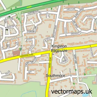
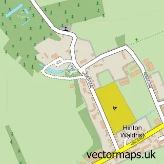
This Kingston Bagpuize street map is a detailed vector street map covering a 750m x 750m area. Select a larger area to create and download your own vector street map of Kingston Bagpuize.
The 750-metre map sample for Kingston Bagpuize covers 418 mapped buildings and approximately 19.8 km of road detail, of which 25 named roads are named. The immediate area includes 1 school and 4 MOT stations within 2 miles. The wider area around Kingston Bagpuize features 2 tourism points of interest and 1 food and drink venue. To create a larger or custom map of Kingston Bagpuize, the map builder lets you define your own coverage area and download editable SVG, PDF and PNG files.
Create a larger editable map of Kingston Bagpuize
Choose any area you need and generate a high-quality vector map instantly. Perfect for print, planning, design, business and personal use.

This Kingston Bagpuize street map in Oxfordshire is available as downloadable SVG, PDF and PNG map files, or as a printed map for planning, business, display, education, local information and design work. You can also create a larger custom map area using the map selector.
What this Kingston Bagpuize map sample shows
Kingston Bagpuize lies within Kingston Bagpuize With Southmoor Cp parish, part of Kingston Bagpuize ward in the Vale Of White Horse District local authority area. The postcode geography for this area includes the OX postcode area, the OX13 postcode district and the OX13 5 postcode sector. Residents fall under the Nhs Buckinghamshire, Oxfordshire And Berkshire West Integrated Care Board for NHS services.
Local features near Kingston Bagpuize
Within 2 milesAmenities and services in and around Kingston Bagpuize.
Administrative and postcode information for Kingston Bagpuize
Kingston Bagpuize lies within Kingston Bagpuize With Southmoor Cp parish, part of Kingston Bagpuize ward in the Vale Of White Horse District local authority area. The postcode geography for this area includes the OX postcode area, the OX13 postcode district and the OX13 5 postcode sector. Residents fall under the Nhs Buckinghamshire, Oxfordshire And Berkshire West Integrated Care Board for NHS services.
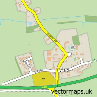
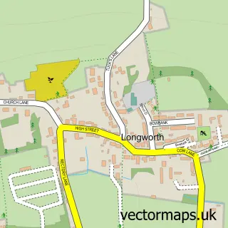
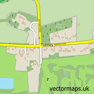
Nearby street map samples around Kingston Bagpuize


More street maps in Oxfordshire
750 metre map area coverage
Boundary, postcode and point of interest information for the 750m x 750m rectangle centred on this sample map.
Boundaries containing map centre
Constituency: Witney Co Const
County: Oxfordshire County
District: Vale of White Horse District
Icb: NHS Thames Valley ICB
Parish: Kingston Bagpuize with Southmoor CP
Police Force: thames valley
Postcode District: OX13
Postcode Sector: OX13 5
Ward: Kingston Bagpuize Ward
Nearby boundaries intersecting sample
Parish: Longworth CP
Ward: Thames Ward
Postcode coverage
POI category counts
Building Supply Store: 2
Chiropractor: 2
Contractor: 2
Event Planning: 2
Preschool: 2
Scout Hall: 2
Sports Club And League: 2
Travel: 2
Accountant: 1
Anglican Church: 1
Sample points of interest
- KN Cloud Accounts and Bookkeeping
- St John the Baptist
- Bagpuize Bicycles
- Cotswold Rainwater Services Limited
- Cotswold Rainwater Services Ltd.
- Signtex Ltd
- Elegant Cuisine
- Espina Chiropractic Clinic
- Espina Chiropractic Clinic
- Costa Express
- J&S House of Design
- The Kitchen Depot
Create a larger editable map of Kingston Bagpuize
This sample shows only a 750 metre area. To create a larger map of Kingston Bagpuize, use our map builder to choose your own coverage area, add titles and download editable SVG, PDF and PNG files.
Create a custom map of Kingston Bagpuize