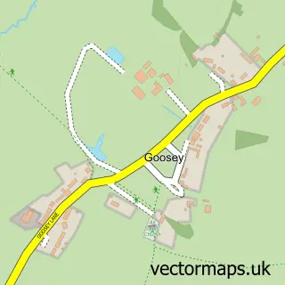
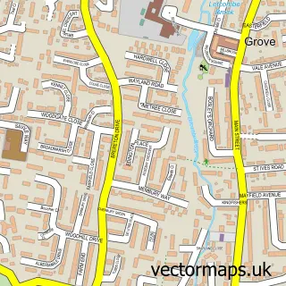
This Lyford street map is a detailed vector street map covering a 750m x 750m area. Select a larger area to create and download your own vector street map of Lyford.
The 750-metre map sample for Lyford covers 37 mapped buildings and approximately 7.8 km of road detail, of which 1 named road are named. To create a larger or custom map of Lyford, the map builder lets you define your own coverage area and download editable SVG, PDF and PNG files.
Create a larger editable map of Lyford
Choose any area you need and generate a high-quality vector map instantly. Perfect for print, planning, design, business and personal use.

This Lyford street map in Oxfordshire is available as downloadable SVG, PDF and PNG map files, or as a printed map for planning, business, display, education, local information and design work. You can also create a larger custom map area using the map selector.
What this Lyford map sample shows
Lyford lies within Lyford Cp parish, part of Kingston Bagpuize ward in the Vale Of White Horse District local authority area. The postcode geography for this area includes the OX postcode area, the OX12 postcode district and the OX12 0 postcode sector. Residents fall under the Nhs Buckinghamshire, Oxfordshire And Berkshire West Integrated Care Board for NHS services.
Local features near Lyford
Within 2 milesAmenities and services in and around Lyford.
Administrative and postcode information for Lyford
Lyford lies within Lyford Cp parish, part of Kingston Bagpuize ward in the Vale Of White Horse District local authority area. The postcode geography for this area includes the OX postcode area, the OX12 postcode district and the OX12 0 postcode sector. Residents fall under the Nhs Buckinghamshire, Oxfordshire And Berkshire West Integrated Care Board for NHS services.
Nearby street map samples around Lyford

More street maps in Oxfordshire
750 metre map area coverage
Boundary, postcode and point of interest information for the 750m x 750m rectangle centred on this sample map.
Boundaries containing map centre
Constituency: Witney Co Const
County: Oxfordshire County
District: Vale of White Horse District
Icb: NHS Thames Valley ICB
Parish: Lyford CP
Police Force: thames valley
Postcode District: OX12
Postcode Sector: OX12 0
Ward: Kingston Bagpuize Ward
Nearby boundaries intersecting sample
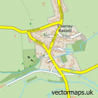
Parish: Charney Bassett CP
Postcode coverage
POI category counts
Automotive Repair: 2
Retail: 2
Windows Installation: 2
Accountant: 1
Advertising Agency: 1
Anglican Church: 1
Auto Body Shop: 1
Building Supply Store: 1
Distribution Services: 1
Financial Service: 1
Sample points of interest
- Inca Accountants
- AGM Support Services
- St Mary's Church Lyford
- AT Automotive Ltd
- At Automotive
- Simply Clutches & Cambelts Ltd
- ASH Chimney Sweep
- Agm Support Services Ltd.
- INCA Financial Services
- Cottrell
- TLC Installations
- Studio Focus Recording
Create a larger editable map of Lyford
This sample shows only a 750 metre area. To create a larger map of Lyford, use our map builder to choose your own coverage area, add titles and download editable SVG, PDF and PNG files.
Create a custom map of Lyford