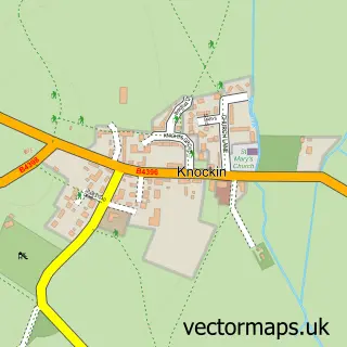
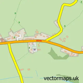
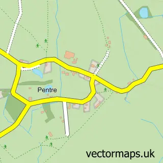
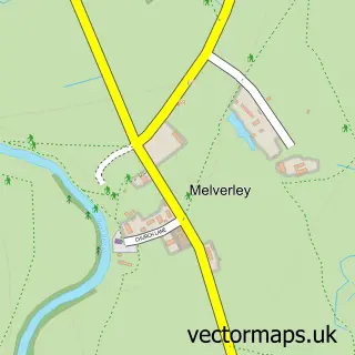
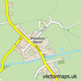
This Kinnerley street map is a detailed vector street map covering a 750m x 750m area. Select a larger area to create and download your own vector street map of Kinnerley.
The 750-metre map sample for Kinnerley covers 141 mapped buildings and approximately 7.7 km of road detail, of which 2 named roads are named. The immediate area includes 1 school, 1 GP surgery within 2 miles and 2 pubs. The wider area around Kinnerley features 1 tourism point of interest, 2 food and drink venues and 1 campsite within 2 miles. To create a larger or custom map of Kinnerley, the map builder lets you define your own coverage area and download editable SVG, PDF and PNG files.
Create a larger editable map of Kinnerley
Choose any area you need and generate a high-quality vector map instantly. Perfect for print, planning, design, business and personal use.

This Kinnerley street map in Shropshire is available as downloadable SVG, PDF and PNG map files, or as a printed map for planning, business, display, education, local information and design work. You can also create a larger custom map area using the map selector.
What this Kinnerley map sample shows
Kinnerley lies within Kinnerley Cp parish, part of Llanymynech ward in the Shropshire local authority area. The postcode geography for this area includes the SY postcode area, the SY10 postcode district and the SY10 8 postcode sector. Residents fall under the Nhs Shropshire, Telford And Wrekin Integrated Care Board for NHS services.
Local features near Kinnerley
Within 2 milesAmenities and services in and around Kinnerley.
Administrative and postcode information for Kinnerley
Kinnerley lies within Kinnerley Cp parish, part of Llanymynech ward in the Shropshire local authority area. The postcode geography for this area includes the SY postcode area, the SY10 postcode district and the SY10 8 postcode sector. Residents fall under the Nhs Shropshire, Telford And Wrekin Integrated Care Board for NHS services.
Nearby street map samples around Kinnerley

More street maps in Shropshire
750 metre map area coverage
Boundary, postcode and point of interest information for the 750m x 750m rectangle centred on this sample map.
Boundaries containing map centre
Constituency: North Shropshire Co Const
District: Shropshire
Icb: NHS Shropshire Telford and Wrekin ICB
Parish: Kinnerley CP
Police Force: west mercia
Postcode District: SY10
Postcode Sector: SY10 8
Nearby boundaries intersecting sample
Parish: Knockin CP
Postcode coverage
POI category counts
Shipping Center: 3
Church Cathedral: 2
Plumbing: 2
Pub: 2
Anglican Church: 1
Building Supply Store: 1
Candy Store: 1
Community Center: 1
Convenience Store: 1
Elementary School: 1
Sample points of interest
- Kinnerley St. Mary
- Advanced Roofline Systems
- Oh So Sweetie
- Melverley Parish Church
- St Mary's Church
- Kinnerley Parish Hall
- Costcutter
- Kinnerley Church of England Controlled Primary School
- Argoed, Shropshire
- La Jolie Ronde Languages for Children
- Border Temperature Control
- Stubbs Plumbing & Heating
Create a larger editable map of Kinnerley
This sample shows only a 750 metre area. To create a larger map of Kinnerley, use our map builder to choose your own coverage area, add titles and download editable SVG, PDF and PNG files.
Create a custom map of Kinnerley