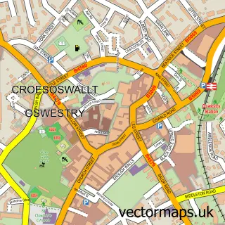
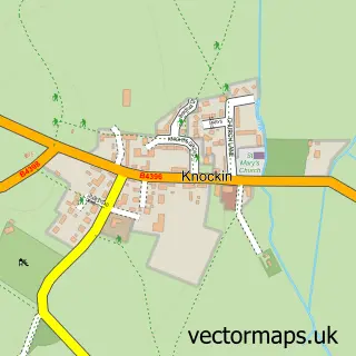
This West Felton street map is a detailed vector street map covering a 750m x 750m area. Select a larger area to create and download your own vector street map of West Felton.
The 750-metre map sample for West Felton covers 268 mapped buildings and approximately 13.3 km of road detail, of which 18 named roads are named. The immediate area includes 1 pub. The wider area around West Felton features 1 food and drink venue. To create a larger or custom map of West Felton, the map builder lets you define your own coverage area and download editable SVG, PDF and PNG files.
Create a larger editable map of West Felton
Choose any area you need and generate a high-quality vector map instantly. Perfect for print, planning, design, business and personal use.

This West Felton street map in Shropshire is available as downloadable SVG, PDF and PNG map files, or as a printed map for planning, business, display, education, local information and design work. You can also create a larger custom map area using the map selector.
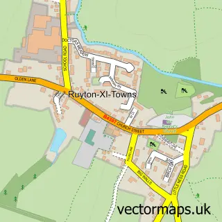
What this West Felton map sample shows
West Felton lies within West Felton Cp parish, part of Whittington ward in the Shropshire local authority area. The postcode geography for this area includes the SY postcode area, the SY11 postcode district and the SY11 4 postcode sector. Residents fall under the Nhs Shropshire, Telford And Wrekin Integrated Care Board for NHS services.
Local features near West Felton
Within 2 milesAmenities and services in and around West Felton.
Administrative and postcode information for West Felton
West Felton lies within West Felton Cp parish, part of Whittington ward in the Shropshire local authority area. The postcode geography for this area includes the SY postcode area, the SY11 postcode district and the SY11 4 postcode sector. Residents fall under the Nhs Shropshire, Telford And Wrekin Integrated Care Board for NHS services.
Nearby street map samples around West Felton

More street maps in Shropshire
750 metre map area coverage
Boundary, postcode and point of interest information for the 750m x 750m rectangle centred on this sample map.
Boundaries containing map centre
Constituency: North Shropshire Co Const
District: Shropshire
Icb: NHS Shropshire Telford and Wrekin ICB
Parish: West Felton CP
Police Force: west mercia
Postcode District: SY11
Postcode Sector: SY11 4
Nearby boundaries intersecting sample
Parish: Ruyton-XI-Towns CP
Postcode coverage
POI category counts
Active Life: 1
Arts And Crafts: 1
Assisted Living Facility: 1
Bakery: 1
Contractor: 1
Convenience Store: 1
Driving School: 1
Holiday Rental Home: 1
Korean Grocery Store: 1
Landscaping: 1
Sample points of interest
- RockGuardZ
- Art Materials UK
- The Court Care Home in Shropshire - Southern Cross Healthcare
- Chimes Cakes
- Shropshire Landscapes
- Post Office-West Felton
- Claire's School of Motoring
- Tedsmore Cottages
- Shell
- Shropshire Landscapes
- CMS Video
- Extreme Bykesportz
Create a larger editable map of West Felton
This sample shows only a 750 metre area. To create a larger map of West Felton, use our map builder to choose your own coverage area, add titles and download editable SVG, PDF and PNG files.
Create a custom map of West Felton