Vector Maps logo
Home Why it works Popular maps Districts Samples Customizer Create Your Map
VectorMaps.uk
Home Popular maps Districts Samples Customizer Create Your Map Privacy Disclaimer
Home / UK Maps / The Stewartry of Kirkcudbright / Kippford Map

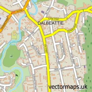
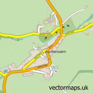
This Kippford street map is a detailed vector street map covering a 750m x 750m area. Select a larger area to create and download your own vector street map of Kippford.

Kippford is a village in The Stewartry Of Kirkcudbright, in the South Scotland of Scotland. Historically, the area formed part of Kirkcudbrightshire. The settlement falls within the Dumfries And Galloway parliamentary constituency. It is served by the DG5

The 750-metre map sample for Kippford covers 119 mapped buildings and approximately 5.9 km of road detail, of which 4 named roads are named. The immediate area includes 1 pub. The wider area around Kippford features 1 food and drink venue, 4 hotels and 2 campsites within 2 miles. To create a larger or custom map of Kippford, the map builder lets you define your own coverage area and download editable SVG, PDF and PNG files.

119Buildings
5.89 kmRoads
4Named roads
0Residents within 2 miles
Create your own

Create a larger editable map of Kippford

Choose any area you need and generate a high-quality vector map instantly. Perfect for print, planning, design, business and personal use.

Choose any location
Editable SVG files
Any size up to A0
PDF, PNG & more
Instant download
High quality guaranteed
Create My Custom Map
Secure, private & no credit card required
Kippford Vector Street Map
750m Sample
Kippford vector street map sample showing roads, buildings and local features in a 750 metre preview area
Buy Kippford Map Print from £12.95 Buy Kippford Digital Map from £6

This Kippford street map in The Stewartry of Kirkcudbright is available as downloadable SVG, PDF and PNG map files, or as a printed map for planning, business, display, education, local information and design work. You can also create a larger custom map area using the map selector.

What this Kippford map sample shows

Kippford lies within Dumfries And Galloway parish, part of Abbey ward in the Dumfries And Galloway local authority area. The postcode geography for this area includes the DG postcode area, the DG5 postcode district and the DG5 4 postcode sector. Residents fall under the Dumfries And Galloway for NHS services.

Local features near Kippford

Within 2 miles

Amenities and services in and around Kippford.

2 Campsites within 2 miles
1 Food & drink
1 Pubs
4 Hotels

Counts are approximate and based on publicly available data.

Administrative and postcode information for Kippford

Kippford lies within Dumfries And Galloway parish, part of Abbey ward in the Dumfries And Galloway local authority area. The postcode geography for this area includes the DG postcode area, the DG5 postcode district and the DG5 4 postcode sector. Residents fall under the Dumfries And Galloway for NHS services.

Parish DUMFRIES AND GALLOWAY
Ward Abbey
District / local authority Dumfries and Galloway
County The Stewartry of Kirkcudbright
Historic county Kirkcudbrightshire
Postcode district DG5
Postcode sector DG5 4
Parliamentary constituency Dumfries and Galloway
Region South Scotland
Country Scotland

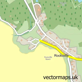
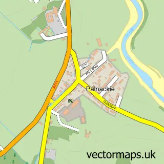
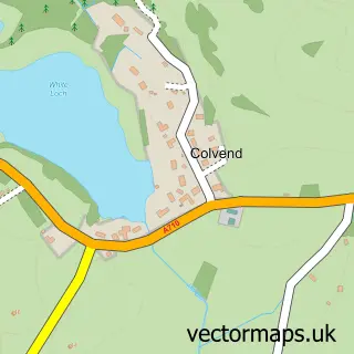
Nearby street map samples around Kippford

Street map sample of Dalbeattie, The Stewartry of Kirkcudbright Dalbeattie Town - The Stewartry of Kirkcudbright - 3.5 miles Street map sample of Carlisle, Cumbria Carlisle City - Cumbria - 34.9 miles Street map sample of Rockcliffe, The Stewartry of Kirkcudbright Rockcliffe Village - The Stewartry of Kirkcudbright - 1.2 miles Street map sample of Palnackie, The Stewartry of Kirkcudbright Palnackie Village - The Stewartry of Kirkcudbright - 1.4 miles Street map sample of Colvend, The Stewartry of Kirkcudbright Colvend Village - The Stewartry of Kirkcudbright - 2.0 miles Street map sample of Sandyhills, The Stewartry of Kirkcudbright Sandyhills Village - The Stewartry of Kirkcudbright - 3.3 miles Street map sample of Auchencairn, The Stewartry of Kirkcudbright Auchencairn Village - The Stewartry of Kirkcudbright - 3.4 miles Street map sample of Rascarrel, The Stewartry of Kirkcudbright Rascarrel Village - The Stewartry of Kirkcudbright - 5.3 miles Street map sample of Rhonehouse, The Stewartry of Kirkcudbright Rhonehouse Village - The Stewartry of Kirkcudbright - 6.4 miles Street map sample of Haugh of Urr, The Stewartry of Kirkcudbright Haugh of Urr Village - The Stewartry of Kirkcudbright - 6.9 miles

More street maps in The Stewartry of Kirkcudbright

Street map sample of Rockcliffe, The Stewartry of Kirkcudbright Rockcliffe Village - 1.2 miles Street map sample of Palnackie, The Stewartry of Kirkcudbright Palnackie Village - 1.4 miles Street map sample of Colvend, The Stewartry of Kirkcudbright Colvend Village - 2.0 miles Street map sample of Sandyhills, The Stewartry of Kirkcudbright Sandyhills Village - 3.3 miles Street map sample of Auchencairn, The Stewartry of Kirkcudbright Auchencairn Village - 3.4 miles

750 metre map area coverage

Boundary, postcode and point of interest information for the 750m x 750m rectangle centred on this sample map.

Boundaries containing map centre

Constituency: Dumfries and Galloway Co Const

District: Dumfries and Galloway

Icb: Dumfries and Galloway

Postcode District: DG5

Postcode Sector: DG5 4

Ward: Abbey Ward

Nearby boundaries intersecting sample

Ward: Castle Douglas and Crocketford Ward

Postcode coverage

DG5 DG5 4

POI category counts

Hotel: 4

Holiday Rental Home: 3

Bed And Breakfast: 1

Cottage: 1

Hotel Bar: 1

Pub: 1

Sports Club And League: 1

Structure And Geography: 1

Sample points of interest

  • Rosemount Guest House Bed And Breakfast
  • Hazelmount Cottage Cottage
  • Fairport Holiday Rental Home
  • Kendoon Apartment, Castle Douglas Holiday Rental Home
  • Magnet Cottage Kippford Holiday Rental Home
  • Allonby Holiday Cottage Kippford Hotel
  • Mariner Hotel Hotel
  • The Anchor Hotel Hotel
  • The Anchor Hotel, Kippford Hotel
  • The Mariner Hotel, Kippford Hotel Bar
  • Anchor Hotel Pub
  • The Solway Yacht Club Sports Club And League

Create a larger editable map of Kippford

This sample shows only a 750 metre area. To create a larger map of Kippford, use our map builder to choose your own coverage area, add titles and download editable SVG, PDF and PNG files.

Create a custom map of Kippford

Phone 01751 473136 | Copyright Vectormaps.uk 2026

Samples Customizer Privacy Disclaimer
Kippford Vector Street Map
Kippford enlarged street map sample showing a 750 metre preview area