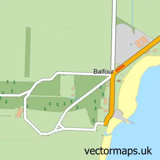
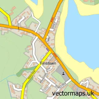
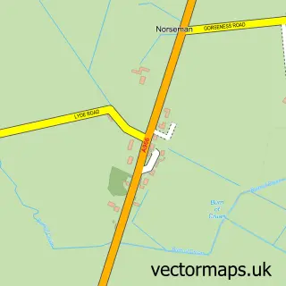
This Kirkwall street map is a detailed vector street map covering a 750m x 750m area. Select a larger area to create and download your own vector street map of Kirkwall.
The 750-metre map sample for Kirkwall covers 148 mapped buildings and approximately 20.2 km of road detail, of which 51 named roads are named. The immediate area includes 3 GP surgeries within 2 miles, 5 pubs and 2 MOT stations, with 9 within 2 miles. The wider area around Kirkwall features 10 tourism points of interest, 20 food and drink venues and 18 hotels. To create a larger or custom map of Kirkwall, the map builder lets you define your own coverage area and download editable SVG, PDF and PNG files.
Create a larger editable map of Kirkwall
Choose any area you need and generate a high-quality vector map instantly. Perfect for print, planning, design, business and personal use.

This Kirkwall street map in Orkney is available as downloadable SVG, PDF and PNG map files, or as a printed map for planning, business, display, education, local information and design work. You can also create a larger custom map area using the map selector.
What this Kirkwall map sample shows
Kirkwall lies within Orkney Islands parish, part of Kirkwall West And Orphir ward in the Orkney Islands local authority area. The postcode geography for this area includes the KW postcode area, the KW15 postcode district and the KW15 1 postcode sector. Residents fall under the Orkney for NHS services.
Local features near Kirkwall
Within 2 milesAmenities and services in and around Kirkwall.
Administrative and postcode information for Kirkwall
Kirkwall lies within Orkney Islands parish, part of Kirkwall West And Orphir ward in the Orkney Islands local authority area. The postcode geography for this area includes the KW postcode area, the KW15 postcode district and the KW15 1 postcode sector. Residents fall under the Orkney for NHS services.
Nearby street map samples around Kirkwall

More street maps in Orkney
750 metre map area coverage
Boundary, postcode and point of interest information for the 750m x 750m rectangle centred on this sample map.
Boundaries containing map centre
Constituency: Orkney and Shetland Co Const
District: Orkney Islands
Icb: Orkney
Postcode District: KW15
Postcode Sector: KW15 1
Ward: Kirkwall East Ward, Kirkwall West and Orphir Ward
Nearby boundaries intersecting sample
No additional intersecting boundaries found.
Postcode coverage
POI category counts
Hotel: 18
Charity Organization: 16
Clothing Store: 8
Jewelry Store: 8
Professional Services: 8
Cafe: 7
Arts And Crafts: 6
Bank Credit Union: 6
Car Dealer: 6
Church Cathedral: 6
Sample points of interest
- Kirkwall Orkney Self Catering 'The Old Endie Hoose'
- Orcadia
- Scholes Chartered Accountants
- The Long Partnership
- OIC Sport and Leisure
- Sea Kayak 59 Degrees North
- Orkney Cattle Breeding Services
- Kirkwall Airport
- Busters Diner
- Orkney Television Enterprise
- Badly Drawn Cat
- Lorraine Bruce Art
Create a larger editable map of Kirkwall
This sample shows only a 750 metre area. To create a larger map of Kirkwall, use our map builder to choose your own coverage area, add titles and download editable SVG, PDF and PNG files.
Create a custom map of Kirkwall