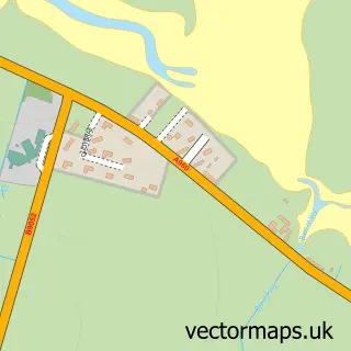
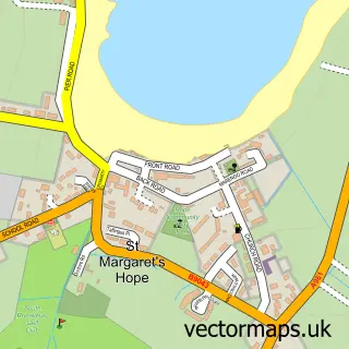
This St Mary's street map is a detailed vector street map covering a 750m x 750m area. Select a larger area to create and download your own vector street map of St Mary's.
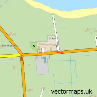
The 750-metre map sample for St Mary's covers 42 mapped buildings and approximately 6.2 km of road detail, of which 6 named roads are named. The wider area around St Mary's features 1 food and drink venue and 1 hotel. To create a larger or custom map of St Mary's, the map builder lets you define your own coverage area and download editable SVG, PDF and PNG files.
Create a larger editable map of St Mary's
Choose any area you need and generate a high-quality vector map instantly. Perfect for print, planning, design, business and personal use.

This St Mary's street map in Orkney is available as downloadable SVG, PDF and PNG map files, or as a printed map for planning, business, display, education, local information and design work. You can also create a larger custom map area using the map selector.
What this St Mary's map sample shows
St Mary's lies within Orkney Islands parish, part of East Mainland, South Ronaldsay And Burray ward in the Orkney Islands local authority area. The postcode geography for this area includes the KW postcode area, the KW17 postcode district and the KW17 2 postcode sector. Residents fall under the Orkney for NHS services.
Local features near St Mary's
Within 2 milesAmenities and services in and around St Mary's.
Administrative and postcode information for St Mary's
The local authority covering St Mary's is Orkney Islands, within the county of Orkney. The settlement lies within East Mainland, South Ronaldsay And Burray ward and Orkney Islands civil parish. The KW17 postcode district and KW17 2 postcode sector serve the immediate area. NHS provision in the area is delivered through Orkney.
Nearby street map samples around St Mary's

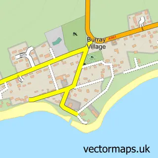
More street maps in Orkney
750 metre map area coverage
Boundary, postcode and point of interest information for the 750m x 750m rectangle centred on this sample map.
Boundaries containing map centre
Constituency: Orkney and Shetland Co Const
District: Orkney Islands
Icb: Orkney
Postcode District: KW17
Postcode Sector: KW17 2
Ward: East Mainland, South Ronaldsay and Burray Ward
Nearby boundaries intersecting sample
No additional intersecting boundaries found.
Postcode coverage
POI category counts
Post Office: 2
Charity Organization: 1
Construction Services: 1
Fountain: 1
Hotel: 1
Martial Arts Club: 1
Restaurant: 1
Shipping Center: 1
Sample points of interest
- Loch Of Ayre Walkway - Holm, Orkney Islands, KW17 2RT
- Alfred Flett LTD
- St Mary's, Orkney
- The Inn Guest House
- SBG Orkney
- Holm Post Office
- Holm Shop & Post Office
- Commodore Chalets
- Post Office-Holm
Create a larger editable map of St Mary's
This sample shows only a 750 metre area. To create a larger map of St Mary's, use our map builder to choose your own coverage area, add titles and download editable SVG, PDF and PNG files.
Create a custom map of St Mary's