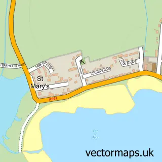
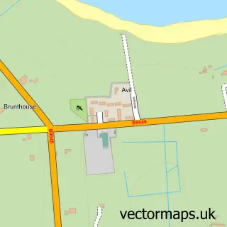
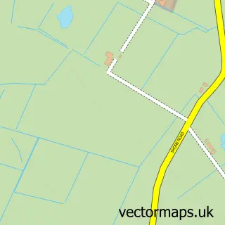
This St Margaret's Hope street map is a detailed vector street map covering a 750m x 750m area. Select a larger area to create and download your own vector street map of St Margaret's Hope.
The 750-metre map sample for St Margaret's Hope covers 73 mapped buildings and approximately 10.7 km of road detail, of which 12 named roads are named. The immediate area includes 1 GP surgery. The wider area around St Margaret's Hope features 4 tourism points of interest, 1 hotel and 1 campsite within 2 miles. To create a larger or custom map of St Margaret's Hope, the map builder lets you define your own coverage area and download editable SVG, PDF and PNG files.
Create a larger editable map of St Margaret's Hope
Choose any area you need and generate a high-quality vector map instantly. Perfect for print, planning, design, business and personal use.

This St Margaret's Hope street map in Orkney is available as downloadable SVG, PDF and PNG map files, or as a printed map for planning, business, display, education, local information and design work. You can also create a larger custom map area using the map selector.
What this St Margaret's Hope map sample shows
St Margaret's Hope lies within Orkney Islands parish, part of East Mainland, South Ronaldsay And Burray ward in the Orkney Islands local authority area. The postcode geography for this area includes the KW postcode area, the KW17 postcode district and the KW17 2 postcode sector. Residents fall under the Orkney for NHS services.
Local features near St Margaret's Hope
Within 2 milesAmenities and services in and around St Margaret's Hope.
Administrative and postcode information for St Margaret's Hope
St Margaret's Hope lies within Orkney Islands parish, part of East Mainland, South Ronaldsay And Burray ward in the Orkney Islands local authority area. The postcode geography for this area includes the KW postcode area, the KW17 postcode district and the KW17 2 postcode sector. Residents fall under the Orkney for NHS services.
Nearby street map samples around St Margaret's Hope

More street maps in Orkney
750 metre map area coverage
Boundary, postcode and point of interest information for the 750m x 750m rectangle centred on this sample map.
Boundaries containing map centre
Constituency: Orkney and Shetland Co Const
District: Orkney Islands
Icb: Orkney
Postcode District: KW17
Postcode Sector: KW17 2
Ward: East Mainland, South Ronaldsay and Burray Ward
Nearby boundaries intersecting sample
No additional intersecting boundaries found.
Postcode coverage
POI category counts
Bed And Breakfast: 2
Holiday Rental Home: 2
Arts And Crafts: 1
Attractions And Activities: 1
Bar: 1
Building Contractor: 1
Church Cathedral: 1
Community Center: 1
Community Services Non Profits: 1
Convenience Store: 1
Sample points of interest
- St Margaret's Hope Workshop and Loft Gallery
- Marengo Community Garden
- Robertsons
- Murray Arms Hotel
- St. Margaret's Cottage
- The Hoxa Tapestry Gallery
- South Ronaldsay and Burray Church
- Marengo Centre
- South Ronaldsay & Burray Agricultural Society
- The Old Trading Post
- Daisy Villa Medical Practice (Isle Of South Ronaldsay)
- Leo Kerr mirrors
Create a larger editable map of St Margaret's Hope
This sample shows only a 750 metre area. To create a larger map of St Margaret's Hope, use our map builder to choose your own coverage area, add titles and download editable SVG, PDF and PNG files.
Create a custom map of St Margaret's Hope