This Kirton street map is a detailed vector street map covering a 750m x 750m area. Select a larger area to create and download your own vector street map of Kirton.
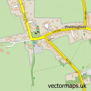
The 750-metre map sample for Kirton covers 242 mapped buildings and approximately 8.8 km of road detail, of which 11 named roads are named. The immediate area includes 2 pubs and 1 MOT station within 2 miles. The wider area around Kirton features 2 food and drink venues, 1 hotel and 2 campsites within 2 miles. To create a larger or custom map of Kirton, the map builder lets you define your own coverage area and download editable SVG, PDF and PNG files.
Create a larger editable map of Kirton
Choose any area you need and generate a high-quality vector map instantly. Perfect for print, planning, design, business and personal use.

This Kirton street map in Suffolk is available as downloadable SVG, PDF and PNG map files, or as a printed map for planning, business, display, education, local information and design work. You can also create a larger custom map area using the map selector.
What this Kirton map sample shows
Kirton lies within Kirton Cp parish, part of Orwell & Villages ward in the East Suffolk District local authority area. The postcode geography for this area includes the IP postcode area, the IP10 postcode district and the IP10 0 postcode sector. Residents fall under the Nhs Suffolk And North East Essex Integrated Care Board for NHS services.
Local features near Kirton
Within 2 milesAmenities and services in and around Kirton.
Administrative and postcode information for Kirton
The local authority covering Kirton is East Suffolk District, within the county of Suffolk. The settlement lies within Orwell & Villages ward and Kirton Cp civil parish. The IP10 postcode district and IP10 0 postcode sector serve the immediate area. NHS provision in the area is delivered through East Suffolk And North Essex Nhs Foundation Trust.
Nearby street map samples around Kirton

More street maps in Suffolk
750 metre map area coverage
Boundary, postcode and point of interest information for the 750m x 750m rectangle centred on this sample map.
Boundaries containing map centre
Constituency: Suffolk Coastal Co Const
County: Suffolk County
District: East Suffolk District
Icb: NHS Essex ICB
Parish: Kirton CP
Police Force: suffolk
Postcode District: IP10
Postcode Sector: IP10 0
Ward: Orwell & Villages Ward
Nearby boundaries intersecting sample
No additional intersecting boundaries found.
Postcode coverage
POI category counts
Building Supply Store: 2
Pet Groomer: 2
Pub: 2
Scout Hall: 2
Web Designer: 2
Anglican Church: 1
Education: 1
Fishmonger: 1
Freight And Cargo Service: 1
Gutter Service: 1
Sample points of interest
- Kirton, St Mary and St Martin
- Kirton Windows
- Simon Warrington Cabinet Maker & Carpenter
- Twinkletoes Pre-School
- Kittiwake Fresh Fish
- Freight Consultants
- Clint’s Gutter Cleaning
- Anglian Aqua Window Cleaning Services
- Fernside Bed & Breakfast
- Unicorn Designers
- Big A Bounce
- E Jacobs and Sons
Create a larger editable map of Kirton
This sample shows only a 750 metre area. To create a larger map of Kirton, use our map builder to choose your own coverage area, add titles and download editable SVG, PDF and PNG files.
Create a custom map of Kirton