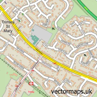
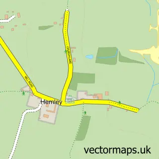
This Trimley St Martin street map is a detailed vector street map covering a 750m x 750m area. Select a larger area to create and download your own vector street map of Trimley St Martin.
The 750-metre map sample for Trimley St Martin covers 441 mapped buildings and approximately 18.3 km of road detail, of which 24 named roads are named. The immediate area includes 1 GP surgery within 2 miles, 1 pub and 2 MOT stations within 2 miles. The wider area around Trimley St Martin features 1 food and drink venue. To create a larger or custom map of Trimley St Martin, the map builder lets you define your own coverage area and download editable SVG, PDF and PNG files.
Create a larger editable map of Trimley St Martin
Choose any area you need and generate a high-quality vector map instantly. Perfect for print, planning, design, business and personal use.

This Trimley St Martin street map in Suffolk is available as downloadable SVG, PDF and PNG map files, or as a printed map for planning, business, display, education, local information and design work. You can also create a larger custom map area using the map selector.
What this Trimley St Martin map sample shows
Trimley St Martin lies within Trimley St. Martin Cp parish, part of Orwell & Villages ward in the East Suffolk District local authority area. The postcode geography for this area includes the IP postcode area, the IP11 postcode district and the IP11 0 postcode sector. Residents fall under the Nhs Suffolk And North East Essex Integrated Care Board for NHS services.
Local features near Trimley St Martin
Within 2 milesAmenities and services in and around Trimley St Martin.
Administrative and postcode information for Trimley St Martin
The local authority covering Trimley St Martin is East Suffolk District, within the county of Suffolk. The settlement lies within Orwell & Villages ward and Trimley St. Martin Cp civil parish. The IP11 postcode district and IP11 0 postcode sector serve the immediate area. NHS provision in the area is delivered through East Suffolk And North Essex Nhs Foundation Trust.
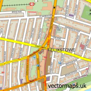
Nearby street map samples around Trimley St Martin

More street maps in Suffolk
750 metre map area coverage
Boundary, postcode and point of interest information for the 750m x 750m rectangle centred on this sample map.
Boundaries containing map centre
Constituency: Suffolk Coastal Co Const
County: Suffolk County
District: East Suffolk District
Icb: NHS Essex ICB
Parish: Trimley St. Martin CP
Police Force: suffolk
Postcode District: IP11
Postcode Sector: IP11 0
Ward: Orwell & Villages Ward
Nearby boundaries intersecting sample
No additional intersecting boundaries found.
Postcode coverage
POI category counts
Driving School: 2
Active Life: 1
Advertising Agency: 1
Arts And Entertainment: 1
Butcher Shop: 1
Electrician: 1
Farmers Market: 1
Flooring Contractors: 1
Freight And Cargo Service: 1
Gym: 1
Sample points of interest
- Dilly's Personal Training
- Louise Richardson Design
- Trimley Memorial Hall
- Sausage shop
- Glenns Training Services
- Shaun Read Driving School
- Mill Lane Electrical Services
- Gosling's Farm Shop
- Albright Carpet & Upholstery Cleaning
- OBC Shipping
- Superhero Fitness
- Cavendish Grove
Create a larger editable map of Trimley St Martin
This sample shows only a 750 metre area. To create a larger map of Trimley St Martin, use our map builder to choose your own coverage area, add titles and download editable SVG, PDF and PNG files.
Create a custom map of Trimley St Martin