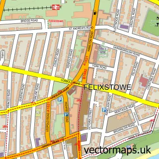
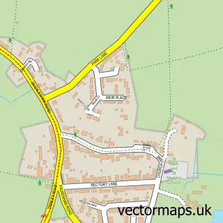
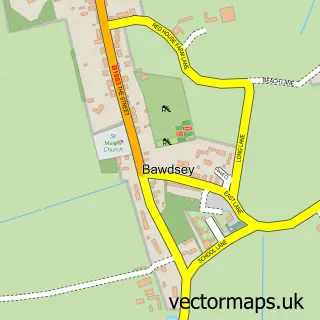
This Walton street map is a detailed vector street map covering a 750m x 750m area. Select a larger area to create and download your own vector street map of Walton.
The 750-metre map sample for Walton covers 577 mapped buildings and approximately 18.0 km of road detail, of which 34 named roads are named. The immediate area includes 3 GP surgeries within 2 miles, 3 pubs and 8 MOT stations within 2 miles. The wider area around Walton features 3 tourism points of interest, 4 food and drink venues and 1 hotel. To create a larger or custom map of Walton, the map builder lets you define your own coverage area and download editable SVG, PDF and PNG files.
Create a larger editable map of Walton
Choose any area you need and generate a high-quality vector map instantly. Perfect for print, planning, design, business and personal use.

This Walton street map in Suffolk is available as downloadable SVG, PDF and PNG map files, or as a printed map for planning, business, display, education, local information and design work. You can also create a larger custom map area using the map selector.
What this Walton map sample shows
Walton lies within Felixstowe Cp parish, part of Eastern Felixstowe ward in the East Suffolk District local authority area. The postcode geography for this area includes the IP postcode area, the IP11 postcode district and the IP11 9 postcode sector. Residents fall under the Nhs Suffolk And North East Essex Integrated Care Board for NHS services.
Local features near Walton
Within 2 milesAmenities and services in and around Walton.
Administrative and postcode information for Walton
The local authority covering Walton is East Suffolk District, within the county of Suffolk. The settlement lies within Eastern Felixstowe ward and Felixstowe Cp civil parish. The IP11 postcode district and IP11 9 postcode sector serve the immediate area. NHS provision in the area is delivered through East Suffolk And North Essex Nhs Foundation Trust.
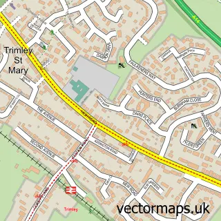
Nearby street map samples around Walton

More street maps in Suffolk
750 metre map area coverage
Boundary, postcode and point of interest information for the 750m x 750m rectangle centred on this sample map.
Boundaries containing map centre
Constituency: Suffolk Coastal Co Const
County: Suffolk County
District: East Suffolk District
Icb: NHS Essex ICB
Parish: Felixstowe CP
Police Force: suffolk
Postcode District: IP11
Postcode Sector: IP11 9
Ward: Western Felixstowe Ward
Nearby boundaries intersecting sample
Ward: Eastern Felixstowe Ward
Postcode coverage
POI category counts
Beauty Salon: 5
Professional Services: 4
Church Cathedral: 3
Convenience Store: 3
Dentist: 3
Hair Salon: 3
Pub: 3
Barber: 2
Building Supply Store: 2
Butcher Shop: 2
Sample points of interest
- St Mary the Virgin
- East of England Co-op WALTON (CZC)
- Showlite Sound & Light
- Northcut Locks
- Scott Maddison
- Anglian Remaps
- The Bread Basket
- Maidstone Road Baptist Church
- Falcon Inn
- Maddocks Barbershop
- Walton Barbers
- Ashley Scott Wellbeing
Create a larger editable map of Walton
This sample shows only a 750 metre area. To create a larger map of Walton, use our map builder to choose your own coverage area, add titles and download editable SVG, PDF and PNG files.
Create a custom map of Walton