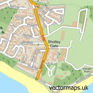
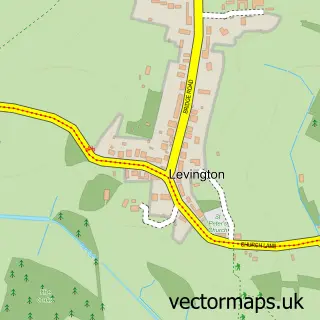
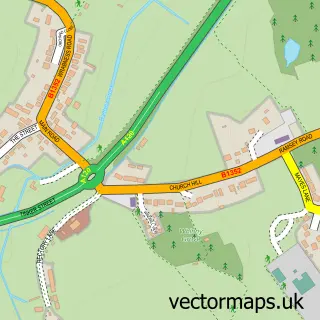
This Shotley street map is a detailed vector street map covering a 750m x 750m area. Select a larger area to create and download your own vector street map of Shotley.
The 750-metre map sample for Shotley covers 153 mapped buildings and approximately 8.8 km of road detail, of which 6 named roads are named. The immediate area includes 1 school, 1 pub and 2 MOT stations within 2 miles. The wider area around Shotley features 1 food and drink venue. To create a larger or custom map of Shotley, the map builder lets you define your own coverage area and download editable SVG, PDF and PNG files.
Create a larger editable map of Shotley
Choose any area you need and generate a high-quality vector map instantly. Perfect for print, planning, design, business and personal use.

This Shotley street map in Suffolk is available as downloadable SVG, PDF and PNG map files, or as a printed map for planning, business, display, education, local information and design work. You can also create a larger custom map area using the map selector.
What this Shotley map sample shows
Shotley lies within Shotley Cp parish, part of Ganges ward in the Babergh District local authority area. The postcode geography for this area includes the IP postcode area, the IP9 postcode district and the IP9 1 postcode sector. Residents fall under the Nhs Suffolk And North East Essex Integrated Care Board for NHS services.
Local features near Shotley
Within 2 milesAmenities and services in and around Shotley.
Administrative and postcode information for Shotley
Shotley lies within Shotley Cp parish, part of Ganges ward in the Babergh District local authority area. The postcode geography for this area includes the IP postcode area, the IP9 postcode district and the IP9 1 postcode sector. Residents fall under the Nhs Suffolk And North East Essex Integrated Care Board for NHS services.
Nearby street map samples around Shotley

More street maps in Suffolk
750 metre map area coverage
Boundary, postcode and point of interest information for the 750m x 750m rectangle centred on this sample map.
Boundaries containing map centre
Constituency: South Suffolk Co Const
County: Suffolk County
District: Babergh District
Icb: NHS Essex ICB
Parish: Shotley CP
Police Force: suffolk
Postcode District: IP9
Postcode Sector: IP9 1
Ward: Ganges Ward
Nearby boundaries intersecting sample
Parish: Arwarton CP
Postcode coverage
POI category counts
Convenience Store: 2
Bar: 1
Beauty Salon: 1
Contractor: 1
Doctor: 1
Elementary School: 1
Engineering Services: 1
Fast Food Restaurant: 1
Home Cleaning: 1
Package Locker: 1
Sample points of interest
- The Rose Inn
- The Hair Boutique
- J and T Nichols Plastering
- Premier
- Premier Shotley PO
- The Holbrook and Shotley Practice
- Shotley Community Primary School
- AD Rigging Solutions
- Lasan Indian Takeaway
- The Clearance Solution
- InPost
- R A S Painting & Decorating Services
Create a larger editable map of Shotley
This sample shows only a 750 metre area. To create a larger map of Shotley, use our map builder to choose your own coverage area, add titles and download editable SVG, PDF and PNG files.
Create a custom map of Shotley