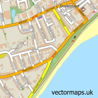
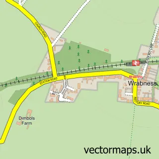
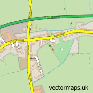
This Ramsey street map is a detailed vector street map covering a 750m x 750m area. Select a larger area to create and download your own vector street map of Ramsey.
The 750-metre map sample for Ramsey covers 148 mapped buildings and approximately 9.5 km of road detail, of which 10 named roads are named. The immediate area includes 1 school, 2 GP surgeries within 2 miles, 2 pubs and 1 MOT station, with 3 within 2 miles. The wider area around Ramsey features 1 tourism point of interest and 2 food and drink venues. To create a larger or custom map of Ramsey, the map builder lets you define your own coverage area and download editable SVG, PDF and PNG files.
Create a larger editable map of Ramsey
Choose any area you need and generate a high-quality vector map instantly. Perfect for print, planning, design, business and personal use.

This Ramsey street map in Essex is available as downloadable SVG, PDF and PNG map files, or as a printed map for planning, business, display, education, local information and design work. You can also create a larger custom map area using the map selector.
What this Ramsey map sample shows
Ramsey lies within Ramsey And Parkeston Cp parish, part of Stour Valley ward in the Tendring District local authority area. The postcode geography for this area includes the CO postcode area, the CO12 postcode district and the CO12 5 postcode sector. Residents fall under the Nhs Suffolk And North East Essex Integrated Care Board for NHS services.
Local features near Ramsey
Within 2 milesAmenities and services in and around Ramsey.
Administrative and postcode information for Ramsey
Ramsey lies within Ramsey And Parkeston Cp parish, part of Stour Valley ward in the Tendring District local authority area. The postcode geography for this area includes the CO postcode area, the CO12 postcode district and the CO12 5 postcode sector. Residents fall under the Nhs Suffolk And North East Essex Integrated Care Board for NHS services.
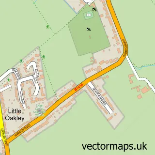
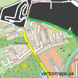
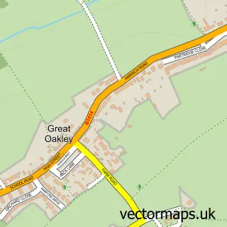
Nearby street map samples around Ramsey

More street maps in Essex
750 metre map area coverage
Boundary, postcode and point of interest information for the 750m x 750m rectangle centred on this sample map.
Boundaries containing map centre
Constituency: Harwich and North Essex Co Const
County: Essex County
District: Tendring District
Icb: NHS Essex ICB
Parish: Ramsey and Parkeston CP
Police Force: essex
Postcode District: CO12
Postcode Sector: CO12 5
Ward: Stour Valley Ward
Nearby boundaries intersecting sample
Constituency: Clacton Co Const
Parish: Little Oakley CP
Ward: The Oakleys & Wix Ward
Postcode coverage
POI category counts
Anglican Church: 2
Elementary School: 2
Pub: 2
Attractions And Activities: 1
Automotive Repair: 1
Butcher Shop: 1
Church Cathedral: 1
Horse Riding: 1
Podiatrist: 1
Post Office: 1
Sample points of interest
- St Michael's Church
- St Michaels' Church, Ramsey
- Ramsey War Memorial Hall and Field
- Ramsey Hill Garage
- Ramsey Master Butchers
- Dovercourt Congregation of Jehovah's Witnesses
- Two Village Church of England Primary School
- Two Village Primary
- Pony Pals
- Evangeline Brown
- Great Oakley Post Office
- Yellow Brick Road Nursery
Create a larger editable map of Ramsey
This sample shows only a 750 metre area. To create a larger map of Ramsey, use our map builder to choose your own coverage area, add titles and download editable SVG, PDF and PNG files.
Create a custom map of Ramsey