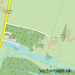
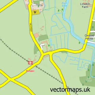
This Lamas street map is a detailed vector street map covering a 750m x 750m area. Select a larger area to create and download your own vector street map of Lamas.
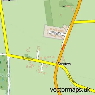
The 750-metre map sample for Lamas covers 87 mapped buildings and approximately 4.7 km of road detail, of which 3 named roads are named. The immediate area includes 1 MOT station within 2 miles. The wider area around Lamas features 1 tourism point of interest. To create a larger or custom map of Lamas, the map builder lets you define your own coverage area and download editable SVG, PDF and PNG files.
Create a larger editable map of Lamas
Choose any area you need and generate a high-quality vector map instantly. Perfect for print, planning, design, business and personal use.

This Lamas street map in Norfolk is available as downloadable SVG, PDF and PNG map files, or as a printed map for planning, business, display, education, local information and design work. You can also create a larger custom map area using the map selector.
What this Lamas map sample shows
Lamas lies within Buxton With Lammas Cp parish, part of Buxton ward in the Broadland District local authority area. The postcode geography for this area includes the NR postcode area, the NR10 postcode district and the NR10 5 postcode sector. Residents fall under the Nhs Norfolk And Waveney Integrated Care Board for NHS services.
Local features near Lamas
Within 2 milesAmenities and services in and around Lamas.
Administrative and postcode information for Lamas
Lamas lies within Buxton With Lammas Cp parish, part of Buxton ward in the Broadland District local authority area. The postcode geography for this area includes the NR postcode area, the NR10 postcode district and the NR10 5 postcode sector. Residents fall under the Nhs Norfolk And Waveney Integrated Care Board for NHS services.
Nearby street map samples around Lamas

More street maps in Norfolk
750 metre map area coverage
Boundary, postcode and point of interest information for the 750m x 750m rectangle centred on this sample map.
Boundaries containing map centre
Constituency: Broadland and Fakenham Co Const
County: Norfolk County
District: Broadland District
Icb: NHS Norfolk and Waveney ICB
Parish: Buxton with Lammas CP
Police Force: norfolk
Postcode District: NR10
Postcode Sector: NR10 5
Ward: Buxton Ward
Nearby boundaries intersecting sample
No additional intersecting boundaries found.
Postcode coverage
POI category counts
Automotive Repair: 2
Water Treatment Equipment And Services: 2
Anglican Church: 1
Auto Customization: 1
Building Supply Store: 1
Car Dealer: 1
Caterer: 1
Community Center: 1
Gift Shop: 1
Home Cleaning: 1
Sample points of interest
- Lammas: St Andrew
- Paragon
- Apollo Sports Cars
- DMD Auto Services
- Blayneys Cleaning Fairies
- Bure Valley Classics
- Frozen Ingredients
- Lammas Village Hall
- Kerris Farmhouse Pine
- KG Cleaning Solutions
- Buxton with Lamas
- Steel-FX
Create a larger editable map of Lamas
This sample shows only a 750 metre area. To create a larger map of Lamas, use our map builder to choose your own coverage area, add titles and download editable SVG, PDF and PNG files.
Create a custom map of Lamas