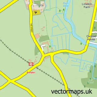
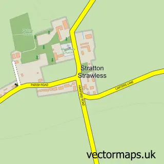
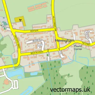
This Buxton street map is a detailed vector street map covering a 750m x 750m area. Select a larger area to create and download your own vector street map of Buxton.
The 750-metre map sample for Buxton covers 327 mapped buildings and approximately 13.0 km of road detail, of which 16 named roads are named. The immediate area includes 1 school, 1 railway station and 1 MOT station within 2 miles. The wider area around Buxton features 1 hotel. To create a larger or custom map of Buxton, the map builder lets you define your own coverage area and download editable SVG, PDF and PNG files.
Create a larger editable map of Buxton
Choose any area you need and generate a high-quality vector map instantly. Perfect for print, planning, design, business and personal use.

This Buxton street map in Norfolk is available as downloadable SVG, PDF and PNG map files, or as a printed map for planning, business, display, education, local information and design work. You can also create a larger custom map area using the map selector.
What this Buxton map sample shows
Buxton lies within Buxton With Lammas Cp parish, part of Buxton ward in the Broadland District local authority area. The postcode geography for this area includes the NR postcode area, the NR10 postcode district and the NR10 5 postcode sector. Residents fall under the Nhs Norfolk And Waveney Integrated Care Board for NHS services.
Local features near Buxton
Within 2 milesAmenities and services in and around Buxton.
Administrative and postcode information for Buxton
The local authority covering Buxton is Broadland District, within the county of Norfolk. The settlement lies within Buxton ward and Buxton With Lammas Cp civil parish. The NR10 postcode district and NR10 5 postcode sector serve the immediate area. NHS provision in the area is delivered through Norfolk And Norwich University Hospitals Nhs Foundation Trust.
Nearby street map samples around Buxton

More street maps in Norfolk
750 metre map area coverage
Boundary, postcode and point of interest information for the 750m x 750m rectangle centred on this sample map.
Boundaries containing map centre
Constituency: Broadland and Fakenham Co Const
County: Norfolk County
District: Broadland District
Icb: NHS Norfolk and Waveney ICB
Parish: Buxton with Lammas CP
Police Force: norfolk
Postcode District: NR10
Postcode Sector: NR10 5
Ward: Buxton Ward
Nearby boundaries intersecting sample
No additional intersecting boundaries found.
Postcode coverage
POI category counts
Driving School: 4
Elementary School: 2
Home Health Care: 2
Post Office: 2
Property Management: 2
Scout Hall: 2
Self Catering Accommodation: 2
Anglican Church: 1
Assisted Living Facility: 1
Beauty Salon: 1
Sample points of interest
- Buxton: St Andrew
- Liaise - Salcasa - Buxton
- Sissy's Head to Toe
- ND Bookkeeping
- Buxton Fish & Chip Shop
- Buxton Village Hall
- Morrisons Daily
- D S I
- DSI Driving School Instructors
- Dsi Driving Instructors Norwich
- Red Driving Instructor
- Buxton Primary School
Create a larger editable map of Buxton
This sample shows only a 750 metre area. To create a larger map of Buxton, use our map builder to choose your own coverage area, add titles and download editable SVG, PDF and PNG files.
Create a custom map of Buxton