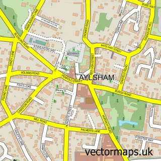
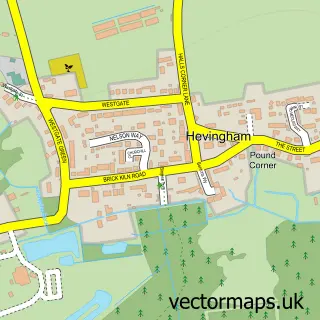
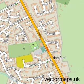
This Hainford street map is a detailed vector street map covering a 750m x 750m area. Select a larger area to create and download your own vector street map of Hainford.
The 750-metre map sample for Hainford covers 154 mapped buildings and approximately 8.7 km of road detail, of which 7 named roads are named. The immediate area includes 1 school, 1 pub and 3 MOT stations within 2 miles. The wider area around Hainford features 1 food and drink venue. To create a larger or custom map of Hainford, the map builder lets you define your own coverage area and download editable SVG, PDF and PNG files.
Create a larger editable map of Hainford
Choose any area you need and generate a high-quality vector map instantly. Perfect for print, planning, design, business and personal use.

This Hainford street map in Norfolk is available as downloadable SVG, PDF and PNG map files, or as a printed map for planning, business, display, education, local information and design work. You can also create a larger custom map area using the map selector.
What this Hainford map sample shows
Hainford lies within Hainford Cp parish, part of Hevingham ward in the Broadland District local authority area. The postcode geography for this area includes the NR postcode area, the NR10 postcode district and the NR10 3 postcode sector. Residents fall under the Nhs Norfolk And Waveney Integrated Care Board for NHS services.
Local features near Hainford
Within 2 milesAmenities and services in and around Hainford.
Administrative and postcode information for Hainford
The local authority covering Hainford is Broadland District, within the county of Norfolk. The settlement lies within Hevingham ward and Hainford Cp civil parish. The NR10 postcode district and NR10 3 postcode sector serve the immediate area. NHS provision in the area is delivered through Norfolk And Norwich University Hospitals Nhs Foundation Trust.
Nearby street map samples around Hainford

More street maps in Norfolk
750 metre map area coverage
Boundary, postcode and point of interest information for the 750m x 750m rectangle centred on this sample map.
Boundaries containing map centre
Constituency: Broadland and Fakenham Co Const
County: Norfolk County
District: Broadland District
Icb: NHS Norfolk and Waveney ICB
Parish: Hainford CP
Police Force: norfolk
Postcode District: NR10
Postcode Sector: NR10 3
Ward: Hevingham Ward
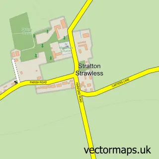
Nearby boundaries intersecting sample
Parish: Stratton Strawless CP
Postcode coverage
POI category counts
Anglican Church: 1
Aquarium: 1
Aquatic Pet Store: 1
Business Manufacturing And Supply: 1
Cemeteries: 1
Eat And Drink: 1
Elementary School: 1
Event Planning: 1
Flowers And Gifts Shop: 1
Lodge: 1
Sample points of interest
- Hainford: All Saints
- Selective Koi Sales
- Selective Koi Sales
- Airfixr
- Norfolk Bluebell Wood Burial Park
- Hainford Honey
- Hainford Primary Partnership School
- The Barn at The Chequers
- Ellen's Florist
- Springwater Lakes & Lodges
- The Chequers Hainford
Create a larger editable map of Hainford
This sample shows only a 750 metre area. To create a larger map of Hainford, use our map builder to choose your own coverage area, add titles and download editable SVG, PDF and PNG files.
Create a custom map of Hainford