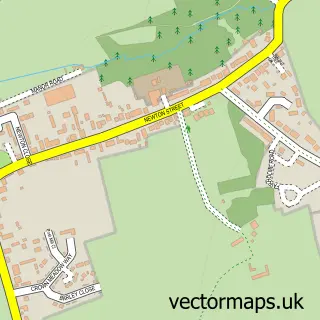
This Hevingham street map is a detailed vector street map covering a 750m x 750m area. Select a larger area to create and download your own vector street map of Hevingham.
The 750-metre map sample for Hevingham covers 219 mapped buildings and approximately 7.6 km of road detail, of which 12 named roads are named. The immediate area includes 1 school and 1 MOT station within 2 miles. The wider area around Hevingham features 1 campsite within 2 miles. To create a larger or custom map of Hevingham, the map builder lets you define your own coverage area and download editable SVG, PDF and PNG files.
Create a larger editable map of Hevingham
Choose any area you need and generate a high-quality vector map instantly. Perfect for print, planning, design, business and personal use.

This Hevingham street map in Norfolk is available as downloadable SVG, PDF and PNG map files, or as a printed map for planning, business, display, education, local information and design work. You can also create a larger custom map area using the map selector.
What this Hevingham map sample shows
Hevingham lies within Hevingham Cp parish, part of Hevingham ward in the Broadland District local authority area. The postcode geography for this area includes the NR postcode area, the NR10 postcode district and the NR10 5 postcode sector. Residents fall under the Nhs Norfolk And Waveney Integrated Care Board for NHS services.
Local features near Hevingham
Within 2 milesAmenities and services in and around Hevingham.
Administrative and postcode information for Hevingham
The local authority covering Hevingham is Broadland District, within the county of Norfolk. The settlement lies within Hevingham ward and Hevingham Cp civil parish. The NR10 postcode district and NR10 5 postcode sector serve the immediate area. NHS provision in the area is delivered through Norfolk And Norwich University Hospitals Nhs Foundation Trust.
Nearby street map samples around Hevingham

More street maps in Norfolk
750 metre map area coverage
Boundary, postcode and point of interest information for the 750m x 750m rectangle centred on this sample map.
Boundaries containing map centre
Constituency: Broadland and Fakenham Co Const
County: Norfolk County
District: Broadland District
Icb: NHS Norfolk and Waveney ICB
Parish: Hevingham CP
Police Force: norfolk
Postcode District: NR10
Postcode Sector: NR10 5
Ward: Hevingham Ward
Nearby boundaries intersecting sample
No additional intersecting boundaries found.
Postcode coverage
POI category counts
Elementary School: 2
Animal Shelter: 1
Art Gallery: 1
Bar: 1
Beauty Salon: 1
Books Mags Music And Video: 1
Bus Service: 1
Construction Services: 1
Educational Services: 1
Elevator Service: 1
Sample points of interest
- Cedar House Cattery
- Nial Adams Art Gallery
- The Knights Arms
- Be Beautiful
- Usborne Books at Home
- Sunbeam Luxury Coaches
- Gaskin Builders Limited
- Evolve Dyslexia Solutions
- Hevingham & Marsham Primary School Partnership
- Hevingham Primary School
- East Anglian Lift Co Ltd
- Cobbleacre Park Fishing Lakes
Create a larger editable map of Hevingham
This sample shows only a 750 metre area. To create a larger map of Hevingham, use our map builder to choose your own coverage area, add titles and download editable SVG, PDF and PNG files.
Create a custom map of Hevingham