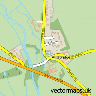
This Felthorpe street map is a detailed vector street map covering a 750m x 750m area. Select a larger area to create and download your own vector street map of Felthorpe.
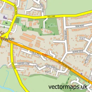
The 750-metre map sample for Felthorpe covers 164 mapped buildings and approximately 9.0 km of road detail, of which 6 named roads are named. The immediate area includes 1 pub and 1 MOT station, with 2 within 2 miles. The wider area around Felthorpe features 1 food and drink venue and 1 hotel. To create a larger or custom map of Felthorpe, the map builder lets you define your own coverage area and download editable SVG, PDF and PNG files.
Create a larger editable map of Felthorpe
Choose any area you need and generate a high-quality vector map instantly. Perfect for print, planning, design, business and personal use.

This Felthorpe street map in Norfolk is available as downloadable SVG, PDF and PNG map files, or as a printed map for planning, business, display, education, local information and design work. You can also create a larger custom map area using the map selector.
What this Felthorpe map sample shows
Felthorpe lies within Felthorpe Cp parish, part of Horsford And Felthorpe ward in the Broadland District local authority area. The postcode geography for this area includes the NR postcode area, the NR10 postcode district and the NR10 4 postcode sector. Residents fall under the Nhs Norfolk And Waveney Integrated Care Board for NHS services.
Local features near Felthorpe
Within 2 milesAmenities and services in and around Felthorpe.
Administrative and postcode information for Felthorpe
The local authority covering Felthorpe is Broadland District, within the county of Norfolk. The settlement lies within Horsford And Felthorpe ward and Felthorpe Cp civil parish. The NR10 postcode district and NR10 4 postcode sector serve the immediate area. NHS provision in the area is delivered through Norfolk And Norwich University Hospitals Nhs Foundation Trust.
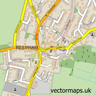
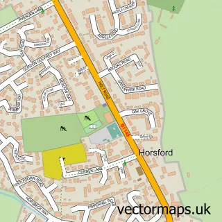
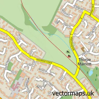
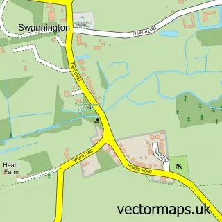
Nearby street map samples around Felthorpe

More street maps in Norfolk
750 metre map area coverage
Boundary, postcode and point of interest information for the 750m x 750m rectangle centred on this sample map.
Boundaries containing map centre
Constituency: Broadland and Fakenham Co Const
County: Norfolk County
District: Broadland District
Icb: NHS Norfolk and Waveney ICB
Parish: Felthorpe CP
Police Force: norfolk
Postcode District: NR10
Postcode Sector: NR10 4
Ward: Horsford and Felthorpe Ward
Nearby boundaries intersecting sample
No additional intersecting boundaries found.
Postcode coverage
POI category counts
Automotive Repair: 4
Auto Manufacturers And Distributors: 1
Building Supply Store: 1
Car Dealer: 1
Discount Store: 1
Dog Walkers: 1
Financial Service: 1
Furniture Store: 1
Hotel: 1
Industrial Equipment: 1
Sample points of interest
- Anglia 4 X 4
- J & S Dack
- Martys Paint Shop
- School Garage
- Verve Fitted Bedrooms
- RTB Roofing & Building Ltd.
- Felthorpe Motor Company
- Saves U Right
- Mischievous Mutts Canine Behavioural Therapy And Training
- Lovewell Blake
- Out with the Old
- Lodge Farmhouse
Create a larger editable map of Felthorpe
This sample shows only a 750 metre area. To create a larger map of Felthorpe, use our map builder to choose your own coverage area, add titles and download editable SVG, PDF and PNG files.
Create a custom map of Felthorpe