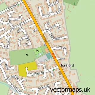
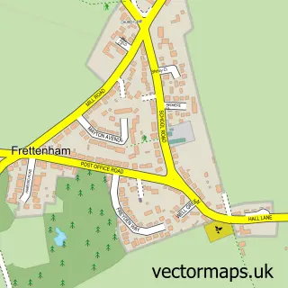
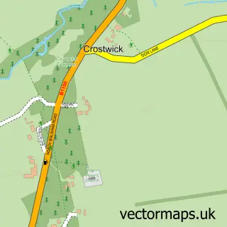
This Horsham St Faith street map is a detailed vector street map covering a 750m x 750m area. Select a larger area to create and download your own vector street map of Horsham St Faith.
The 750-metre map sample for Horsham St Faith covers 196 mapped buildings and approximately 13.8 km of road detail, of which 19 named roads are named. The immediate area includes 2 GP surgeries within 2 miles, 1 pub and 14 MOT stations within 2 miles. The wider area around Horsham St Faith features 1 tourism point of interest, 1 food and drink venue and 1 hotel. To create a larger or custom map of Horsham St Faith, the map builder lets you define your own coverage area and download editable SVG, PDF and PNG files.
Create a larger editable map of Horsham St Faith
Choose any area you need and generate a high-quality vector map instantly. Perfect for print, planning, design, business and personal use.

This Horsham St Faith street map in Norfolk is available as downloadable SVG, PDF and PNG map files, or as a printed map for planning, business, display, education, local information and design work. You can also create a larger custom map area using the map selector.
What this Horsham St Faith map sample shows
Horsham St Faith lies within Horsham St. Faith And Newton St. Faith Cp parish, part of Spixworth With St Faiths ward in the Broadland District local authority area. The postcode geography for this area includes the NR postcode area, the NR10 postcode district and the NR10 3 postcode sector. Residents fall under the Nhs Norfolk And Waveney Integrated Care Board for NHS services.
Local features near Horsham St Faith
Within 2 milesAmenities and services in and around Horsham St Faith.
Administrative and postcode information for Horsham St Faith
The local authority covering Horsham St Faith is Broadland District, within the county of Norfolk. The settlement lies within Spixworth With St Faiths ward and Horsham St. Faith And Newton St. Faith Cp civil parish. The NR10 postcode district and NR10 3 postcode sector serve the immediate area. NHS provision in the area is delivered through Norfolk And Norwich University Hospitals Nhs Foundation Trust.
Nearby street map samples around Horsham St Faith

More street maps in Norfolk
750 metre map area coverage
Boundary, postcode and point of interest information for the 750m x 750m rectangle centred on this sample map.
Boundaries containing map centre
Constituency: Broadland and Fakenham Co Const
County: Norfolk County
District: Broadland District
Icb: NHS Norfolk and Waveney ICB
Parish: Horsham St. Faith and Newton St. Faith CP
Police Force: norfolk
Postcode District: NR10
Postcode Sector: NR10 3
Ward: Spixworth with St. Faiths Ward
Nearby boundaries intersecting sample
Parish: Horsford CP
Ward: Horsford and Felthorpe Ward
Postcode coverage
POI category counts
Doctor: 3
Hvac Services: 3
Business Manufacturing And Supply: 2
Professional Services: 2
Anglican Church: 1
Attractions And Activities: 1
Automotive Repair: 1
Beauty Salon: 1
Bed And Breakfast: 1
Church Cathedral: 1
Sample points of interest
- Horsham w Newton: St Faith
- Horsham St Faiths
- Agriglaze
- Male Waxing Crete
- Elm Farm Country House Ltd.
- Argosy Machinery Ltd
- Oval Tubes
- Horsham St Faiths Church
- Drayton & St Faiths Medical Practice
- Horsham St Faiths Doctors Surgery
- St Faiths Surgery
- Fetch Dog Walking and Training
Create a larger editable map of Horsham St Faith
This sample shows only a 750 metre area. To create a larger map of Horsham St Faith, use our map builder to choose your own coverage area, add titles and download editable SVG, PDF and PNG files.
Create a custom map of Horsham St Faith