Vector Maps logo
Home Why it works Popular maps Districts Samples Customizer Create Your Map
VectorMaps.uk
Home Popular maps Districts Samples Customizer Create Your Map Privacy Disclaimer
Home / UK Maps / Ayrshire and Arran / Lamlash Map

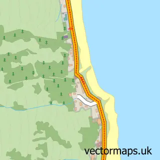
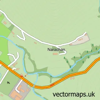
This Lamlash street map is a detailed vector street map covering a 750m x 750m area. Select a larger area to create and download your own vector street map of Lamlash.

Lamlash is a village in Ayrshire And Arran, in the West Scotland of Scotland. Historically, the area formed part of Buteshire. The settlement falls within the North Ayrshire And Arran parliamentary constituency. It is served by the KA27 postcode district,

The 750-metre map sample for Lamlash covers 91 mapped buildings and approximately 5.2 km of road detail, of which 4 named roads are named. The immediate area includes 1 GP surgery within 2 miles, 1 pub and 1 MOT station. The wider area around Lamlash features 1 tourism point of interest, 4 food and drink venues and 7 hotels. To create a larger or custom map of Lamlash, the map builder lets you define your own coverage area and download editable SVG, PDF and PNG files.

91Buildings
5.24 kmRoads
4Named roads
0Residents within 2 miles
Create your own

Create a larger editable map of Lamlash

Choose any area you need and generate a high-quality vector map instantly. Perfect for print, planning, design, business and personal use.

Choose any location
Editable SVG files
Any size up to A0
PDF, PNG & more
Instant download
High quality guaranteed
Create My Custom Map
Secure, private & no credit card required
Lamlash Vector Street Map
750m Sample
Lamlash vector street map sample showing roads, buildings and local features in a 750 metre preview area
Buy Lamlash Map Print from £12.95 Buy Lamlash Digital Map from £6

This Lamlash street map in Ayrshire and Arran is available as downloadable SVG, PDF and PNG map files, or as a printed map for planning, business, display, education, local information and design work. You can also create a larger custom map area using the map selector.

What this Lamlash map sample shows

Lamlash lies within North Ayrshire parish, part of Ardrossan And Arran ward in the North Ayrshire local authority area. The postcode geography for this area includes the KA postcode area, the KA27 postcode district and the KA27 8 postcode sector. Residents fall under the Ayrshire And Arran for NHS services.

Local features near Lamlash

Within 2 miles

Amenities and services in and around Lamlash.

1 GP surgeries within 2 miles
1 MOT stations 1 within 2 miles
1 Tourism & leisure
4 Food & drink
1 Pubs
7 Hotels
1 Healthcare POIs
2 Vehicle services

Counts are approximate and based on publicly available data.

Administrative and postcode information for Lamlash

The local authority covering Lamlash is North Ayrshire, within the county of Ayrshire And Arran. The settlement lies within Ardrossan And Arran ward and North Ayrshire civil parish. The KA27 postcode district and KA27 8 postcode sector serve the immediate area. NHS provision in the area is delivered through Ayrshire And Arran.

Parish NORTH AYRSHIRE
Ward Ardrossan and Arran
District / local authority North Ayrshire
County Ayrshire and Arran
Historic county Buteshire
Postcode district KA27
Postcode sector KA27 8
Parliamentary constituency North Ayrshire and Arran
Region West Scotland
Country Scotland

Nearby street map samples around Lamlash

Street map sample of Ardrossan, Ayrshire and Arran Ardrossan Town - Ayrshire and Arran - 14.3 miles Street map sample of Glasgow, City of Glasgow Glasgow City - City of Glasgow - 41.0 miles Street map sample of Brodick, Ayrshire and Arran Brodick Village - Ayrshire and Arran - 3.2 miles Street map sample of Whiting Bay, Ayrshire and Arran Whiting Bay Village - Ayrshire and Arran - 3.3 miles Street map sample of Shiskine, Ayrshire and Arran Shiskine Village - Ayrshire and Arran - 7.1 miles Street map sample of Corrie, Ayrshire and Arran Corrie Village - Ayrshire and Arran - 7.7 miles Street map sample of Torbeg, Ayrshire and Arran Torbeg Village - Ayrshire and Arran - 8.0 miles Street map sample of Blackwaterfoot, Ayrshire and Arran Blackwaterfoot Village - Ayrshire and Arran - 8.3 miles Street map sample of Sannox, Ayrshire and Arran Sannox Village - Ayrshire and Arran - 8.8 miles Street map sample of Narachan, Ayrshire and Arran Narachan Village - Ayrshire and Arran - 12.8 miles

More street maps in Ayrshire and Arran

Street map sample of Brodick, Ayrshire and Arran Brodick Village - 3.2 miles Street map sample of Whiting Bay, Ayrshire and Arran Whiting Bay Village - 3.3 miles Street map sample of Shiskine, Ayrshire and Arran Shiskine Village - 7.1 miles Street map sample of Corrie, Ayrshire and Arran Corrie Village - 7.7 miles Street map sample of Torbeg, Ayrshire and Arran Torbeg Village - 8.0 miles

750 metre map area coverage

Boundary, postcode and point of interest information for the 750m x 750m rectangle centred on this sample map.

Boundaries containing map centre

Constituency: North Ayrshire and Arran Co Const

District: North Ayrshire

Icb: Ayrshire and Arran

Postcode District: KA27

Postcode Sector: KA27 8

Ward: Arran Ward

Nearby boundaries intersecting sample

No additional intersecting boundaries found.

Postcode coverage

KA27 KA27 8

POI category counts

Hotel: 7

Bed And Breakfast: 3

Printing Services: 3

Cafe: 2

Community Services Non Profits: 2

Arts And Crafts: 1

Atms: 1

Automotive Repair: 1

Bar: 1

Beauty And Spa: 1

Sample points of interest

  • Black Fox Framing Arts And Crafts
  • The Cooperative Food (G4S) Lamlash, Lamlash Atms
  • Lamlash Garage Automotive Repair
  • Pierhead Tavern Bar
  • Bewitching Beauty on Arran Beauty And Spa
  • Carraig Mhor Bed And Breakfast Bed And Breakfast
  • Stonewater House Bed And Breakfast
  • Stonewater House Bed And Breakfast
  • Chameleon Arran Boutique
  • Seagate Brewery Brewery
  • Island Porcelain Business Manufacturing And Supply
  • Old Pier Tearoom Cafe

Create a larger editable map of Lamlash

This sample shows only a 750 metre area. To create a larger map of Lamlash, use our map builder to choose your own coverage area, add titles and download editable SVG, PDF and PNG files.

Create a custom map of Lamlash

Phone 01751 473136 | Copyright Vectormaps.uk 2026

Samples Customizer Privacy Disclaimer
Lamlash Vector Street Map
Lamlash enlarged street map sample showing a 750 metre preview area